Sunday, October 30, 2011

Plummer House


Los Angeles County -  July 28, 1997

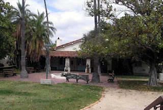
This landmark begs the question; ‘What’s the oldest house in Hollywood doing in Calabasas?’


The answer is that it fell into disrepair and hard times and into an agreement with the folks at the Leonis Adobe Museum (the Leonis and Plummer families were friends btw) moved the landmark house to their grounds in 1983 and restored it. Today, it serves as the museum visitor center and gift shop.


Captain John Cornelius Plummer and his wife, Dona Maria Cecelia Plummer had two sons, Juan (John) and Eugenio. The Plummer house was built about 1874 by sons Juan and Eugenio. The home was a typical ranch house of the times. Wine and brandy were made on the premises. Vegetables, fruits, flowers and dairy products were raised and sold to the people of Los Angeles and local hotels.


The three acre Plummer Park where the Plummer house used to be is in the eastern part of West Hollywood in a predominately Russian medium density neighborhood. There’s a farmer’s market every Monday. Locals are for the most part happy with the park as it is and don’t want to see most of it close in January of 2012 for reconstruction that may take up to two years, nor do they want to lose the mature trees to new trees that will take years to grow.


NO. 160 PLUMMER PARK AND OLDEST HOUSE IN HOLLYWOOD - Known as the 'Oldest House in Hollywood,' this house was built in the 1870s by Eugene Raphael Plummer.
Location: Old location: 7377 Santa Monica Blvd, Hollywood (Los Angeles) New location: 23537 Calabasas Rd, Calabasas
USGS Quadrangle Sheet Name: HOLLYWOOD
GPS: 34.157348,-118.639399

Wednesday, October 19, 2011

Campo de Cahuenga


Los Angeles County -  July 28, 1997 & June 14, 2009

North on 101 for 3.3 miles to Lankershim Blvd. and next to Universal City Station (metro).

Ah, memories of earlier days in the music business at the mention of Lankershim Blvd; the Palomino Club, Nudie’s Rodeo Tailors, The Sportsman’s Lodge…but we’re here in the shadows of Universal City to the site where 110 years prior to Nudie Cohn stitching up Elvis’ gold lame suit, the Mexican Army capitulated and made an agreement with American forces to stop shooting at each other while a treaty was put together.


1976 photo


To describe the details of that agreement it’s best to leave it to Warrant Officer 1 Mark J. Denger representing the California State Military Museum and their fine website on California’s military history.


“At the site of an abandoned adobe ranch-house, Lieutenant Colonel John C. Frémont signed a treaty, generally termed the "Capitulation of Cahuenga," with General Andres Pico of Mexico. This was a significant treaty that led indirectly to California's statehood by ending rival hostilities in California for the duration of the Mexican War.

Campo de Cahuenga was once a part of Rancho Verdugo, occupied by Mariano de la Luz Verdugo. In 1810 the San Fernando Mission had taken over Rancho Partezuela, the Verdugo ranch, and had dammed up the Los Angeles River running behind the Campo de Cahuenga site so as to raise corn and squash for the mission. At that time, the mission fathers built a building for the housing of workers and seed storage. In 1845 Tomas Feliz, the new occupant of the land, doubled the size of this building which is now known as the Tomas Feliz Adobe.

In January of 1847, the last two serious military engagements against U.S. forces invading California were fought at the battles of San Gabriel and La Mesa just below Los Angeles. Gen. Flores, seeing the situation as hopeless, now moved north of the city. In the meantime, Frémont arrived in the Los Angeles area from the north

It was on January 11, 1847, a few miles above San Fernando, that Col. Frémont received a message from Gen. Kearny informing him of the defeat of the enemy and the capture of Los Angeles. That night Frémont's battalion encamped in the mission buildings at San Fernando. From the mission Col. Frémont sent Jesus Pico to find the California army and open negotiations with its leaders. Jesus Pico, a cousin of Gen. Andres Pico, found the advance guard of the Californians encamped on the Verdugo Ranch.

Detained there, Pico informed the leading officers of the army of Frémont's arrival and the number of his men. With the combined forces of Frémont and Stockton, now in Los Angeles, he urged them to surrender to Frémont as they could obtain better terms from him than from Stockton.

General Flores, who had been appointed by the territorial assembly governor and comandante-general, had taken his departure for Mexico on January 11. Before departing he appointed Gen. Andres Pico commanding-general and gave him command of the army.

General Pico, on assuming command, appointed Francisco Rico and Francisco de La Guerra to confer with Col. Frémont.

Meanwhile, Frémont appointed Major P. B. Reading, Major William H. Russell and Captain Louis McLane as commissioners to negotiate a treaty. Gen. Pico, in turn, appointed Jose A. Carrillo, commander of the cavalry squadron, and Augustin Olvera, disputaso of the assembly, and moved his army near the Los Angeles river at Cahuenga. On the 13th Frémont moved his camp to the Cahuenga.

The commissioners met in the deserted ranch-house of Tomas Feliz (Campo de Cahuenga), and a treaty was drawn up.

The principal conditions of the treaty of "Capitulation of Cahuenga," as it was termed, were that the Californians, on delivering up their artillery and public arms, and promising not to again take up arms during the war, and conforming to the laws and regulations of the United States, shall be allowed to peaceably return to their homes. They were to be allowed the same rights and privileges as are allowed to citizens of the United States, and were not to be compelled to take an oath of allegiance until a treaty of peace was signed between the United States and Mexico, and were given the privilege of leaving the country if they so wished to do so.

The terms being mutually acceptable to both Colonel Frémont and General Andres Pico, it was signed. An additional section was added to the treaty on the 16th at Los Angeles releasing the officers from their paroles.

In accordance with the terms of the treaty, two cannon were surrendered, the howitzer captured from Gen. Kerny at San Pasqual, and the "Old Woman's Gun" that won the battle of Dominguez Ranch.

On January 14, Frémont marched his battalion through the Cahuenga Pass to Los Angeles and entered it four days after its surrender to Stockton. The conquest of California was now complete. Frémont presented the treaty to Stockton, who approved it.

In a little more than six months, U.S. naval forces of the Pacific Squadron, aided by the California Battalion, two companies of dragoons, and the Morman Battalion, had seized and pacified the whole area that is, today, the state of California.

To Frémont's credit, the treaty of Campo de Cahuenga (shown below) brought peace with honor, allowing both nationalities in California to calmly assimilate into the United States. The treaty was consolidated into the final treaty of Guadalupe Hidalgo of February 2, 1848, between the United States and Mexico.”


 According to their webpage, the site is currently closed for renovations, as it was in 2009, but will be open soon.     


Plaque inscription: NO. 151 CAMPO DE CAHUENGA - 'Here was made the Treaty of Cahuenga by General Andrés Pico, commanding forces for Mexico, and Lieutenant-Colonel J. C. Frémont, U.S. Army, for the United States. By this treaty, agreed upon January 13th, 1847, the United States acquired California - finally secured to us by the treaty of Guadalupe Hidalgo, made February 2nd, 1848.' This legend was written February 9, 1898 by Mrs. Jessie Benton Frémont. Location: 3919 Lankershim Blvd, North Hollywood
GPS 34.139759,-118.361973

Tuesday, October 18, 2011

Cecil B. DeMille Studio Barn


Los Angeles County -  July 28, 1997 & June 14, 2009


The Studio Barn is now the Hollywood Heritage Museum which is right off the 101 and in a parking lot across from the Hollywood Bowl. From its original 1896 location, the barn was moved to Paramount Studios where it sat for 55 years and was occasionally used as a set. It was saved from destruction and moved to its present location in 1982. On the first visit here in 1997 the building was closed due to fire damage the previous year.


Though not the first movie shot in the LA area (Old California has that distinction), it was the first feature length film made in Hollywood. Back in 1913 most movie sets were open roofed and used natural light, so the fair weather, cheap rents, and endless variety of exterior shots made southern California the obvious choice as the new center for the burgeoning film industry. Another factor was Thomas Edison’s financial lock on east coast filmmakers, think of New York as an iPhone and Hollywood as open architecture Android.


Even in his first feature film, Cecil B. DeMille’s flair for location shooting was in full swing. The saloon set was built by railroad tracks in the San Fernando Valley, while harbor scenes were shot in San Pedro. Meanwhile, they went Keen Camp in Idyllwild for open range cattle shots, and over to Palomar to catch some snow. DeMille’s partners included Jessie Lasky (became Paramount) and Sam Goldwyn (MGM), with comedy film legend Hal Roach doing a bit of acting as well. Even DeMille himself was extra.


Though the adapted stage play is reviewed as being somewhat staid and Victorian in direction, it was made for about $20,000 and grossed nearly $250,000, making it the Blair Witch Project of its day and gave DeMille power and influence. He liked it so much he made the movie again in 1918, and again as a talkie in 1931.  


Plaque inscription: NO. 554 CECIL B. DeMILLE STUDIO BARN - Cecil B. DeMille rented half of this structure, then used as a barn, as the studio in which was made the first feature-length motion picture in Hollywood-The Squaw Man-in 1913. Associated with Mr. DeMille in making The Squaw Man were Samuel Goldwyn and Jesse Lasky, Sr. Originally located at the corner of Selma and Vine Streets, in 1927 the barn was transferred to Paramount Studios.
Location: 2100 N Highland Ave, Hollywood
GPS: 34.108562,-118.336208

Thursday, October 13, 2011

Portola Trail Campsite - Beverly Hills


Los Angeles County - June 14, 2009


From the downtown landmarks just visited it’s cruse down Olympic Blvd. to Beverly Hills and  to one of the multiple sites marking Portola’s trail. The states directions aren’t that specific being that there’s a lot to take in on the 300 block of La Cienega Blvd. with obvious conclusion that the landmark is somewhere in La Cienega Park, a popular place for man and dog, making parking a privilege and not a right. After strolling the park and community center for awhile, the plaque is noticed across the street by the southern tip of the park on the wall of the Margaret Herrick Library, where one leaves the sidewalk, scales the grassy knoll, and steps on landscaping shrubs to read it. In a town where even the dog walkers across the street have publicists, you’d think the Beverly Hills Historical Society or some like organization would spot the plaque in the park where it could be seen by all these folks lounging about where Portola’s people did in 1769.


Beverly Blvd. 1925


Unlike everyone today running about in shorts and flip flops, Portola’s soldiers had to wear heavier garb. By 1769 they did however figure out that metal armor was as ‘off the A list’ as a 30 year old Paris Hilton and they wore unique leather vests that protected against life’s arrows, and were forerunners of those worn by Mexican and American cowboys. The leather vest/jacket was shaped like a coat without sleeves and made of six or seven plies of white tanned deerskin, and could stop arrows except at very close range. The shields were made of two plies of raw bull's hide and carried on the left arm to turn aside spears and arrows, with the rider being able to defend his horse as well as himself. In addition each wore a sort of a leather apron, which the Spanish called "armas" or "defensas," fastened to the pommel of the saddle and hanging down on both sides to protect the thighs and legs in thickets and woods. The truth of the matter was that rather than fending off Indian attacks at every turn they were primarily occupied with regrouping the stock and pack animals that often bolted away, but like Beverly Hills bodyguards, they had to be ready for anything.


Plaque inscription: NO. 665 PORTOLÁ TRAIL CAMPSITE, 2 (S)- The expedition of Don Gaspar de Portolá from Mexico passed this way en route to Monterey to begin the Spanish colonization of California. With Captain Don Fernando Rivera y Moncada, Lieutenant Don Pedro Fages, Sergeant José Francisco Ortega, and Fathers Juan Crespí and Francisco Gómez, Portolá and his party camped near this spot on August 3, 1769.
Location:  300 S block of La Cienega Blvd between Olympic and Gregory, Beverly Hills
GPS: 34.061490,-118.375937

Wednesday, October 12, 2011

Site of the Los Angeles Star


Waymarking.com photo


Los Angeles County -  July 28, 1997 & June 14, 2009


Though we’re right by the Los Angeles Plaza, and a boatload of landmarks, it was not to be on this particular day, but from the Bella Union Hotel site, this one could not be missed since it’s on the same wall. And as it was with the Bella Union plaque, some important points are missed about LA’s first newspaper.

Firstly, it was called La Estrella de Los Angeles and printed half in Spanish and half in English until 1855. Another point was that the paper was ‘suspended temporarily’ was that due to outspoken criticism of the federal government during the civil war, the editor was arrested for treason and the paper banned from the mails. After getting it rolling again in 1868, they made it a daily in 1870, but lack of funds forced its permanent closure in 1879. “In 1852, the Star published a series of 22 articles written by Hugo Reid, a Scottish immigrant living in present day Baldwin Park. These articles, which are the most comprehensive and thorough ethnographic portrait of the Native Americans of Los Angeles County, exposed their plight at the twilight of their existence.” – Michael Several 1997 

With the exception on the LA Herald, the fate of the other dozen or so newspapers that existed before the LA Times began publication in 1881 was similar to the LA Star, and their runs were short.   

You can kill a newspaper but it’s hard to stop the presses. During the Star’s four year hiatus for its confederate stance, the press was used by Phineas Banning to publish his Wilmington Journal, and after the LA Star closed for good, the press went on to duty in Orange County as the Anaheim Gazette. 


Plaque inscription: NO. 789 SITE OF THE LOS ANGELES STAR - Southern California's first newspaper, The Los Angeles Star, was founded in this block on May 17, 1851 and for many years exerted a major influence upon this part of the state. Suspended temporarily from 1864 to 1868, it continued later as an effective voice of the people until its final termination date in 1879.
Location: Fletcher Bowron Square, 300 block of N Main, between Temple and Aliso Sts, Los Angeles
GPS: 34.054437,-118.241140

Tuesday, October 11, 2011

Bella Union Hotel


Los Angeles County -  July 28, 1997 & June 14, 2009 

In what often turns out to be the case, the mark is missed for this landmark. It is depicted as an important gathering center and that the Butterfield Stage used it as a stop on route to San Francisco. Yet it isn’t mentioned that its history goes back to 1835, or that was the last Capitol building of Alta California, or that it was LA County’s first courthouse in 1850, or that it spent the majority of its 105 years as the Saint Charles Hotel.


1870 photo


The structure began as the home of Isaac Williams in 1835, grew a second story in 1851 and a third in 1867. In 1873 it was remodeled and they were calling it the Clarendon, and a few years later became the Saint Charles. In its last few decades the hotel had degenerated to flop house status and in 1940 the historic building was demolished for a parking lot.

Not to keep nagging about the text for this landmark but it wasn’t used by Butterfield all that long. They rented office space for awhile but moved to their own facility on Second & Spring, where the Mirror Building is now. Wells Fargo and Phineas Banning also used the hotel for their stage outfits.

Being the last Capitol building and the first courthouse far outweigh in importance the passing association with the Butterfield Stage Line and the Office of Historic Preservation ought to rethink this one. That said, their mention of Waterman Ormsby’s account and book ‘The Butterfield Overland Mail’ is available and a good read, even if it has little to do with this landmark


1812 war vets in 1873 photo


Plaque inscription: NO. 656 BELLA UNION HOTEL SITE - Near this spot stood the Bella Union Hotel, long a social and political center. Here, on October 7, 1858, the first Butterfield Overland Mail stage from the east arrived 21 days after leaving St. Louis. Warren Hall was the driver, and Waterman Ormsby, a reporter, the only through passenger.
Location: Fletcher Bowron Square, 300 block of N Main, between Temple and Aliso Sts, Los Angeles
GPS: 34.054668,-118.240925

Monday, October 10, 2011

Navy and Marine Corps Reserve Center


Los Angeles County -  July 28, 1997 & June 14, 2009


From the Jewish cemetery site it’s a simple matter of circling around to Stadium Way to the front of the structure and the plaque on the entrance staircase. The military abandoned the facility in the 1990’s and it has since been taken over as a training center for LA Fire.  

Some time back this author was what they call a ‘grounds act’ at county fairs, which included the LA County Fair in Pomona. It was interesting to be a carney for a few weeks out of the year. This is brought up because for a time they used to give orientations to performers so that they knew more about the facility, had talking points, and point folks around the place. One of those points was that exhibit building 4 (built in 1930) was the largest free standing structure without walls around. Maybe that was the case in 1930 but this next landmark claims the same thing. Then there are the blimp hangers at the El Toro air station, which at over 1000 feet long and 300 feet wide were the world’s largest free span structures (1942)….and apparently still are, for those made out of wood. Who knows? One thing for sure, we weren’t afraid of doing big things.


Seeing this place brought back personal memories of a post Viet Nam time in the Marine reserves and being called in to explain associations with ‘known radicals’ on a college campus. Partially shaded by the round hood of the flex desk lamp light, the Commander sat at the grey metal desk in the corner of the large, otherwise empty room with its grey walls and grey floor. From a manila envelope, 8 by 10 glossies verifying the alleged association were presented and thoughts of the obvious film noir implications aside, the recollection was that we were setting up for a little outdoor midday concert by Phil Ochs. So, it was surmised by yours truly that it was most likely the famed protest singer that some intelligence agency was following, and combined with the associate’s faint ties with the SDS, conspiracy theories were developed. The Commander was comforted, and a document was signed stating that being recalled to active duty would not place yours truly under greater hardship than someone else in the same circumstances…..Catch 22. Ironically, our little event was poorly timed and promoted and though Mr. Ochs played a good set from the tiny riser, hardly anyone stopped to listen.      


Plaque inscription: NO. 972 NAVY AND MARINE CORPS RESERVE CENTER - Designed as the largest enclosed structure without walls in the world by noted California architects Robert Clements and Associates, this Art Deco building, constructed between 1938 and 1941 by the WPA, is the largest and second-oldest Navy Reserve Center in the United Stages. It has served as the induction, separation, and training center for more than 100,000 sailors since World War II well as the filming site for countless motion pictures and television shows.
Location: 1700 Stadium Way, Los Angeles
USGS Quadrangle Sheet Name: VENICE
GPS: 34.069032,-118.243060

Sunday, October 9, 2011

First Jewish Site in Los Angeles


Los Angeles County -  July 28, 1997 & june 14, 2009


A home run or two in the opposite direction from home plate in Dodger Stadium will put you out of the parking lot and on Lilac Terrace, the road that loops around the old Navy and Marine Reserve Center (now LA Fire Training Center) from Stadium Way. It’s an easy to miss landmark hidden in the trees by the chain link fence.


The 1850 census for Los Angeles shows there were 15 blacks, 8 Jews, and 2 Chinese, and then all races and religions began to grow quickly. Realizing the need for a place of worship and cemetery, the Hebrew Benevolent Society of Los Angeles was formed in 1854, becoming LA’s first charitable organization. In 1855 they purchased this three acre plot for $1, and it became the final resting place for 300 people. Those graves were moved between 1902 and 1910 to the Home of Peace, located at the corner of Wittier and Eastern. 

Harris Newmark arrived at El Pueblo de Los Angeles in 1853 and stayed on to become a successful Jewish businessman, and commercial leader. He was also a historian with an eye to the past, and the other eye apparently keen to the future:

“When I came, Los Angeles was a sleepy, ambitionless adobe village with very little promise for the future. The messenger of Optimism was deemed a dreamer; but time has more than realized the fantasies of those village oracles, and what they said would some day come to pass in Los Angeles, has come and gone, to be succeeded by things much greater still. ... I believe that Los Angeles is destined to become, in not many years, a world-center, prominent in almost every field of human endeavor.”—Harris Newmark, “Sixty Years in Southern California, 1853-1913”

Harris Newmark’s autobiography ‘Sixty Years in Southern California’ is considered one of the best accounts of the region in the 19th century, and a great read. Though not on the usual readers, the work is in the public domain and available in a number of formats or read online through the Library of Congress.


Plaque inscription: NO. 822 FIRST JEWISH SITE IN LOS ANGELES - The Hebrew Benevolent Society of Los Angeles (1854), first charitable organization in the city, acquired this site from the city council by deed of April 9, 1855. This purchase of a sacred burial ground represented the first organized community effort by the pioneer Jewish settlers.
Location: Chavez Ravine, behind US Naval and Marine Corps Reserve Center, 800 W Lilac Terrace near Lookout Dr, Los Angeles
GPS: 34.069591,-118.241161

Friday, October 7, 2011

Portola Trail Campsite


Los Angeles County -  July 28, 1997


We leave Mendocino County and travel south for a return to the chronological excursion through the state historical landmarks in Los Angeles County. There are so many that it was nice to get away. So far we’ve covered 36, wrote an album of songs, and have 55 remaining, so a few more side trips to other regions and counties are likely before these accounts are complete.

This Sunday outing appears to be a loose slap happy day trip around Los Angeles, Hollywood, and Beverly Hills with no apparent attempt to maximize landmarks or minimize driving. Some of these landmarks were revisited in 2009, for many of the LA County landmark sites and plaques were photographed back in 1997 with imaginary film in the Canon AE-1. 

As we turn off Broadway to Elysian Park Drive, the landmark plaque mounted on a rock sits on the hill just in front of the white swinging security gate to the part. This is one of two Portola campsite landmarks in LA, the other being in Beverly Hills, and one of many throughout the state commemorating the expedition.


Fearing occupation of Alta California by the English (Americans) or the Russians, Spain, in 1767 sought to expand colonies and missions up the west coast from San Diego to Monterey. Ships began arriving in San Diego bay in 1769 and in July of that year Portola, along with 63 soldiers, 100 mules, priests, and gear, headed north. After camping here at these two LA County sites, they headed down Wilshire Blvd. to Santa Monica, and north from there. Wearing leather jackets, the soldiers traveled light compared to the metal armor of earlier expeditions of Coronado’s time.    


Plaque inscription: NO. 655 PORTOLÁ TRAIL CAMPSITE (I) - Spanish colonization of California began in 1769 with the expedition of Don Gaspar de Portolá from Mexico. With Captain Don Fernando Rivera v Moncada, Lieutenant Don Pedro Fages, Sgt. José Francisco Ortega, and Fathers Juan Crespí and Francisco Gómez, he and his party camped near this spot on August 2, 1769, en route to Monterey.
Location: Elysian Park entrance, NW corner of N Broadway and Elysian Park Dr, Los Angeles
GPS: 34.071858,-118.227332


Monday, October 3, 2011

Point Arena Light Station


Mendocino County, July 29, 2010

It looks somewhat like a smokestack as you approach on the little road leading to the lighthouse grounds, and for good reason. After the new structure was built and dedicated in 1908 after the original was damaged in the great San Francisco earthquake of 1906, the lighthouse service contracted with a company that made smokestacks and the reinforced concrete they used is what got this landmark’s state status, since it was the first of its type.


The lighthouse sits on a narrow peninsula that is several hundred feet wide, jetting out on a bluff rising 50 feet above sea level, and its purpose is to warn passing vessels of Arena Rock, a mile long hunk of granite lurking just six feet below the surface. Normally, the light would be enough to warn mariners but the distance of Arena Rock and the extreme fog here made it necessary to add a steam powered fog horn with the lighthouse when it went on line in 1870. So, rather than the quaint traditional light keeper’s dwellings that are the usual fare, Point Arena had a 2 ½ story brick residence that housed the four man crew necessary to run the boilers and their families. Quarters were tight and not very private and the thick walls only partially cut the volume of the fog horn. Huge underground cisterns held the water for the boilers and they went through 100’s of tons of wood to fire them.


1870 Photo


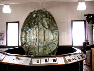
The first order French made Fresnel lens weighs something like six tons and today is on display at the lighthouse. It rotated atop five gallons of mercury which produced a unique flash every six seconds while a suspended weight synced to a clockwork rotated the lens every 18 seconds.


Light keeper Bill Owens served at Point Arena for 15 years from 1937 to 1952, and once while on watch during World War II, he thought he saw a submarine off the point but was told there were no enemy subs in the area. Shortly thereafter the Ameilia was torpedoed just north of Fort Bragg, proving Bill had it right all along. We’ve covered the Ameilia state landmark in the dispatches from Del Norte County some months back.


The light station was dedicated as a state landmark around 2005 and though there is most likely a plaque somewhere, it isn’t displayed on the property, nor could the staff and docents recall seeing it anywhere. This has happened a few times before (especially with recently dedicated landmarks) and plaques have been tracked down to leaning against walls in conference rooms, and storage, but there was no such luck in this case.  


In 1960 the keeper’s bungalows were torn down and replaced by the small and simple ranch houses that remain today and you can rent one for an overnight stay on the bluff…..no bluffing. And while standing on the bluff and basking in the mist, you come to the knowledge that at 2045 nautical miles, you’re at the closest point (not counting Alaska) to Honolulu. For yours truly and the rental VW bug, it was time to close out this run through Mendocino County and head back down to Monte Rio.


Plaque inscription: NO. 1035 Point Arena Light Station -In 1989 the Point Arena Light Station was listed in the National Register of Historic Places for its statewide significance in the area of maritime history.  Coastal traffic increased substantially during the 1860s, and heavy storms and fogs often made trips along the coast treacherous.  The first buildings at the station were constructed in 1870 and were destroyed in 1906 during the San Francisco Earthquake.  At that time the U. S. Lighthouse Service decided to use reinforced concrete in the light house replacement.  Prior to this, reinforced concrete had not been employed in the construction of a California lighthouse.  Thus, when the Point Arena Lighthouse began operation in 1908, it became the first lighthouse of reinforced concreted in the State.  Strikingly situated between the Pacific Ocean to the west and rolling farmland on the east, the Point Arena Light Station retains the character and appearance of one hundred years ago. 
Location:  Lighthouse Road, Point Arena  45500 Lighthouse Road Point Arena, CA 95468   707 882-2777
GPS 38.954537,-123.74043

Saturday, October 1, 2011

Mendocino Presbyterian Church


Mendocino County, July 29, 2010


Easy pickin’s, that’s what it’s like rolling along in the white VW Bug on these north coastal roads going from landmark to landmark that lay in wait with little or no challenge of ‘the hunt’. And that’s a good thing, for with scenery like this, it’s nice to have the time to take it all in, rather than being mired in aimless wandering through conflicting directions. We come up through the bustle of midday traffic on Ukiah Street, which peaks at about two cars per hour, and park across the street from the carpenter gothic structure still in use, the Mendocino Presbyterian Church.


Mendocino -1863


Carpenter gothic construction was the marriage of gothic elements like pointed arches and steep gables, to traditional American light, solid wood frame design. In this case, redwood. By the time the church was built, they had come up with steam powered scroll saws that could mimic High Gothic ornamentation, but the church, like its parishioners, was made well, honest, simple, and straightforward. 


Part of the movie Johnny Belinda was filmed here at the church in 1947 and it brought in enough money to put a new roof on the place. Jane Wyman’s performance got an Oscar.


Plaque inscription: NO. 714 MENDOCINO PRESBYTERIAN CHURCH - This is one of the oldest Protestant churches in continuous use in California. The Presbyterian Church, organized on November 6, 1859, dedicated the redwood building on July 5, 1868.
Location: 44871 Ukiah Street, Mendocino CA 95460
GPS 39.305322,-123.796574