Friday, December 31, 2010

Third Serrano Adobe

June 23, 1993 Riverside County CA
Fifth in a series of nine northbound landmarks seen and a medium length putt from the tanning vats.

As it will be said many times in these writings, to be a California State Landmark, it has to be first, last, biggest, etc., or of unique historical significance to pass muster. Now not being one to nit pick, it just seems the name ‘Third Serrano Adobe’ means this landmark’s elevator doesn’t quite make it to the top. Around these parts south of Corona however, the name ‘Serrano’ is used as often as ‘Alamo’ in San Antonio. As it is for the Serrano Tanning Vats plaque 30’ away, this is a though neighborhood for the adobe’s landmark to be hanging out. It appears that people sometimes use these turnouts for issues other than improving their chops on California history. Thugs and scoundrels of questionable motive have been gnawing away at them for years, as witnessed by the chipping and bashing on the concrete. Thinking these are made of solid bronze, copper, or some precious metal, has some folks resorting to the low handed deed of theft for profit. Some have been successful, but at least for now, not here. 
Plaque inscription: NO. 224 RUINS OF THIRD SERRANO ADOBE - Don Leandro Serrano set out orchards and vineyards and cultivated some of the fertile lands of the Temescal Valley. In the 1840s he built his third adobe, which the Serrano family occupied until 1898, on the well-traveled road between San Diego and Los Angeles.
Location: NE corner of I-15 and
Old Temescal Road
, 8 mi SE of Corona. Google maps: 33.777863,-117.486119


Thursday, December 30, 2010

Serrano Tanning Vats

June 23, 1993 Riverside County
The fourth in a series of nine northbound landmarks seen that day was a twofer…two landmarks at the same site. This one has the state plaque and the Third Serrano Adobe has a local marker. There was a third landmark of some kind in the middle separating the other two, a fancy stone tablet that could have been something important, calling out to those who pass. But when one is on a quest, one stays on theme. Besides, the better half taking the photo was hungry and it didn’t look like the concrete pipe factory was serving tea and sandwiches.
Update: It turns out the good folks amid the halls and corridors of the Temescal Valley Press know what the mystery third landmark is all about. Turns out the Boy Scouts did the good deed of placing a plaque of their own design in 1962…later to be restored in 1981 by those Boy Scouts with beer, E Clampus Vitus.

Tanning in this case does not mean these were little spas for sun bathing. No, they were used for soaking cow hides in lime or lye solutions for separation, or tannin, that alters the structure of the skins into something that doesn’t deteriorate. Nowhere does any information on these vats say exactly what steps in the process of leather making these vats were used for, but for tanning then they used a solution made from oak bark. Tannenbaum is German for oak tree, and derived the word.’ tannin’ from. Or, you could use a lot of red wine.

Plaque inscription: NO. 186 SERRANO TANNING VATS - Nearby, two vats were built in 1819 by the Luiseño Indians under the direction of Leandro Serrano, first non-Indian settler in what is now Riverside County. The vats were used in making leather from cow hides. In 1981 the vats were restored and placed here by the Billy Holcomb Chapter of E Clampus Vitus.
Location: NW corner of I-15 and
Old Temescal Rd
, 8 mi SE of Corona
Google maps: 33.777863,-117.486119

Wednesday, December 29, 2010

Carved Rock

The third landmark in a series of nine seen on June 23, 1993. Looking back, it seems ironic that on this very day in 1993, John Wayne Bobbitt’s wife was doing some carving of her own. At any rate, on this trip, we’ll learn the difference between petroglyphs and pictographs….one is carved, the other, painted.
Carved Rock has been poorly treated, unmaintained, and unrecognized. And, since the 1100 state landmarks largely ignore Native American contributions, this site ought to be preserved better than it is. Add to this the indignity that Carved Rock’s plaque has gone missing.


Them Rock Tainters:               © Radio Flier Music

How bout them rock tainters ain’t they sappy
Defacing Carved Rock seems to make them happy
Doin phony little petroglyphs of eagles and thrushes
Lurkin round the rock with chisels and brushes
Them hugger mugger rock tainters sneekin on they buns
Taintin the boulders of Luiseno Indi-uns
Wanna be a rock tainter, I’ll explain it
Get a stone at home and buck up n’ taint it


If nothing else, the Luiseno people here were clean…with daily bathing nearby at the source that for the last 150 years has been known as Glen Ivy.Hot Springs.


If  there was a plaque at the site it would read: NO. 187 CARVED ROCK - The petroglyphs were carved by the Luiseño Indians, their meaning is said to be: 'A chief died here. These are his plumes, his portrait, his sign, and the animals sacred to him.' The Luiseño Indians who lived in Temescal Valley belonged to the Shoshoean linguistic group. The rock has been damaged by vandals.
Location: In canyon, 0.4 mi N of I-15 (P.M. 32.5), 8 mi S of Corona. Google maps 33.774225,-117.47509


Tuesday, December 28, 2010

Serrano Boulder

Second in a series of nine northbound landmarks seen June 23, 1993 - Riverside County CA
No plaque, no fancy turnout with ‘landmark ahead’ signs, just a smallish boulder stuck in overgrown brush, a little too big to be hauled away by someone looking for a landscaping accent. If one is go the extra mile and a little dirt to reach this location, a step back at the site to contemplate that this was the first house in what is now Riverside County was right here. This boulder was put here by sympathizers of Leandro Serrano acknowledging his being screwed out of his 20,000 acre land grant. At one time there was a landmark plaque…maybe the courts took that away as well.

U.S. Supreme Court: Serrano v. United States, 72 U.S. 5 Wall. 451 451 (1866)
Yeah, the claim went all the way to the Supreme Court. Leandro had been here for over thirty years on land granted by the priests at San Luis Rey, and though possession law and statements from those parties involved in the original transaction would have normally held up as it did for American born landowners under Mexican rule, Serrano got the shaft. Though acquired in similar fashion as a grant, US citizen Jonathon Warner’s land nearby was never in question. Over in Azusa, English born ancestors of my better half’s family were likewise ousted from three square miles of land they paid cold hard cash for in the 1840’s. In the box for ‘occupation’ in the 1880 census, cousin Henry Dalton bluntly states: “Fighting for my rights.”  
This Online Archive of California  photo shows a Luiseno adobe in Temescal valley from around 1900 that would have been very similar to the original Serrano home.

Plaque inscription:
NO. 185 SERRANO BOULDER - As early as 1818, Don Leandro Serrano had cattle, sheep, cultivated land, and orchards in Temescal Valley. The boulder placed by residents of Temescal Valley marks the site of the first house in Riverside County, erected by Leandro Serrano about May 1824.
Location: From I-15, take Old Temescal Canyon Rd S 0.4 mi to Lawson Rd, then go W 0.2 mi to dirt rd, then S 0.1 mi to site, 9 mi S of Corona  Google maps: 33.770033,-117.490894


Monday, December 27, 2010

Old Temescal Road

First in a series of nine northbound landmarks seen June 23, 1993 - Riverside County CA
Like an unfinished project on the garage workbench, this landmark just hasn’t made it to song. It seems to have all the right ingredients, but something else always to shove it aside. Someday. Meanwhile, recent computer access to topographical and satellite maps can show the paths chosen by pioneers in the form of the path of least resistance. Everyone wants a smooth DeSoto-like-ride so sand, large rocks, hills, and water were avoided whenever possible, and the
Old Temescal Road
was no exception. Starting in Corona (originally called South Riverside) at
Ontario Avenue
, it meanders through Temescal Canyon to the hill that leads to Lake Elsinore. The subtle changes in the canyon are overlooked today when plowing up and down interstate 15, missing the old two lane road’s journey as it dipped and ducked under occasional narrow Santa Fe overpasses that would flood in a good fog. Imagine an early summer morning LA to San Diego bound traveler in the DeSoto’s heyday of 1950. After the scent of miles of constant orange and citrus trees through Orange and parts of Riverside Counties, the damp canyon grasses bring a fresh change.
Those good grasses were a primary reason for the cluster of five state landmarks in Temescal Canyon and their stories of early development.
NO.
638 OLD TEMESCAL ROAD
- This route was used by Luiseño and Gabrieleno Indians, whose villages were nearby. Leandro Serrano established a home here in 1820. Jackson and Warner traveled the road in 1831, and Frémont in 1848. It was the southern emigrant road for gold seekers from 1849 to 1851, the Overland Mail route from 1858 to 1861, and a military road between Los Angeles and San Diego from 1861 to 1865.
Location: On Old Hwy 71, 0.9 mi S of I-15 and Temescal Canyon Rd interchange, 11 mi S of Corona
On reservation land. Google coordinates: 33.765609,-117.486699


Sunday, December 26, 2010

The Landmark That Wasn't

June 23, 1993 Riverside County CA
It’s a new day and after a stay and fantastic breakfast at a Temecula B&B and a morning balloon ride, flying low past the local wine country and up through the overcast to the brilliant sunrise above the clouds at 4000’ (a gracious comp from a client) it was time for some real adventure; more state landmarks. First, a comment on ballooning.

One would think that at 4000’ thoughts would dwell on the fact that the only thing preventing a 4000’ fall is hot air and wicker, yet the serenity is overwhelming. So like images of trusting babies suspended from stork beaks and flying through pale blue skies with puff clouds, we ride, viewing the landscape in the scenic slow pan of a John Ford Western. Periodic bursts from the burners assure continued flight to those short of stature, but standing 6’ 4” at burner height, it’s a bit like having one’s head in a foghorn. Thoughts during this flight turn to an autobiography by aviation pioneer Igor Sikorsky read many years before of his wish in those early years of avionics to build ever greater sized, but slow flying aircraft. Though he envisioned planes with pianos and dance floors, his largest effort was a craft called ‘The Grand’, a four engine passenger plane built about the time of the great war in Jules Verne fashion with etched windows, flower vases, and a sprial staircase to the roof walkway where Igor would stroll and smell the fresh Russian air. Elegance lost. The thing only went about 60 miles an hour. He must have felt like my Brittany spaniel with his head out the window of the DeSoto at full tilt. In the basket of a balloon however, it isn’t windy, it can’t be, but it’s a good bet that the free standing rush of a view is much like it was for Igor. Perspective is actually much better as the balloon flies low to the ground in what could be called Peter Pan range. Deft flap control by our pilot yields a soft Oz-like landing and we’re on our way to the first landmark.            


By now a reader may ask; “Who decides what becomes a California state historical landmark?” Well, research into this shows that landmark approval is lengthy and complicated process accomplished by an appointed panel of Hottentots and Potentates consisting of a doctor and a lawyer and an Indian Chief, and led by Way Out Willie, the historian. You submit your information to them and if they dig that crazy beat, they do the hand jive and the application is approved. A new landmark is then christened by the rockin’ Billy Holcomb chapter of E Clampus Vitus. 


The first stop on this day would have been number 1005, the Santa Rosa Rancho site in Murrieta. However, the California landmarks guidebook only went to 986 and the recently established landmark wasn’t listed. Nor was there, or is there to this day. an actual landmark plaque for this site. Apparently, the E Clampus Vitus boys were sitting this one out, as it would be later understood that they were all over most recent dedications and monument construction for as it turns out, the state doesn’t do it.

Old 1005 was the first heartbreak, unable to find on multiple attempts until 1998. There would be a good many others in those days before GPS and turn-by-turn instructions for the common man. On occasion, breaking the golden rule of male drivers everywhere became an option; asking someone for directions. To feel the humbling realization that at some point one has to throw in the towel and move on to fish elsewhere was a bitter pill. Blame then was easy, it was the map’s fault. Not enough detail from the AAA maps in rural areas was often a legitimate case in the attempts to regain masculinity, but after getting Thomas Guides, that dog would no longer hunt. Still, suburban sprawl marches on, often changing the face of these destinations with new or diverted roads, gates, and no trespassing challenges.

Friday, December 24, 2010

Christmas Tree Lane


The mother lode, the oldest example of excessive use of Christmas lights in America. Starting every October, volunteers set the parade course of burning filament in which the floats are stagnant and the parade goers do the parading. My parents and grandparents would have opened their Christmas day copies of the LA Times to see this photo of
Christmas Tree Lane
in 1938. According to the byline: “Altadena’s annual
Christmas Tree Lane
opens on Christmas Eve for motorists to slowly drive through with their headlights off. The deodar trees were decorated with some 10,000 lights.” That’s the way to do it, a brief demonstration of shock and awe witnessed by wide-eyed parents and children in darkened cars inching along and savoring every bulb. It was a destination.
 
UPDATE! Well it's summertime in the desert and you know what that means, time to write a Christmas song. Gonna record this with just a ukulele and vocal soon as the phrasing gets comfortable. The scene is Eagle Rock, Ca. about 1940...but it could be anytime...except for the car.

CHRISTMAS TREE LANE      © Radio Flier Music

Hey there mama, before we put pajamas on
What do ya think about it pop?
We grab little sis, hop in the Studebaker
And leave old Eagle Rock

Christmas time lights, are shining bright
Something like we’ve never ever seen
Just up the road, I’m about to explode
Got to get on to Altadena

 Tall cedar trees running two rows deep
Goes on about a mile long
Hanging lights in a chain, brighten the lane
And like a sleigh we slowly drive along

Goin’ all the way, in the spirit of the holiday
Like peppermint a kid just can’t resist
The trees all glow like electric snow
Down the row on a chilly Christmas

Ch) On parade, in a misty Christmas night
Down the lane, of 10,000 holiday lights
Throw the switch, and light ‘em up once again
And give the reason this season for Mr. and Mrs.
To celebrate the season on Christmas Tree Lane

Every year it’s clear, folks are coming here
To let these little lights surprise
I turn my neck and watch them reflect
In my little sister’s eyes

Trees designed to see them shining
And it doesn’t even cost a dime
Let’s turn around these trees all crowned
And go down one more time


With annual Christmas dinners in nearby Eagle Rock, we’d trek down the lane on occasion, but the other more simple luminary tradition was to pass by the Los Angeles City Hall to view the four sided cross. The lighting tradition went on into the 1970’s when it was pointed out that it was politically incorrect for a public building. Humbug.


The ‘official’ visit to this landmark was August 2, 1998, as we pulled the Olds Silhouette off the 210 to capture the last landmark returning from Lake Tahoe.


Plaque inscription: NO.
990 CHRISTMAS TREE LANE
- The 135 Deodar Cedar trees were planted in 1885 by the Woodbury Family, the founders of Altadena. First organized by F.C. Nash in 1920, the 'Mile of Christmas Trees' has been strung with 10,000 lights each holiday season through the efforts of volunteers and the Christmas Tree Lane Association. It is the oldest large-scale Christmas lighting spectacle in Southern California.
Location: Santa Rosa Ave on both sides of the street from Woodbuty Avenue to Altadena Drive in Altadena  Google maps: 34.181382,-118.140042

Thursday, December 23, 2010

Vallecito

Vallecito and The Lady Ghost in White
June 22, 1993 San Diego County. First in a series (or last on a blog) of nine landmarks visited, and though not one that tends to believe in such things as ghosts..........


James Lassator built a sod house here in the early 1850’s as a stopping place at the first good water in quanity and grasses along the southern emigrant trail from Yuma.  The house became a station for the San Antonio-San Diego mail route known as the ‘Jackass Mail’, and later for the Butterfield Overland Mail and in its reconstructed state, remains one of the chief landmarks of the line. 

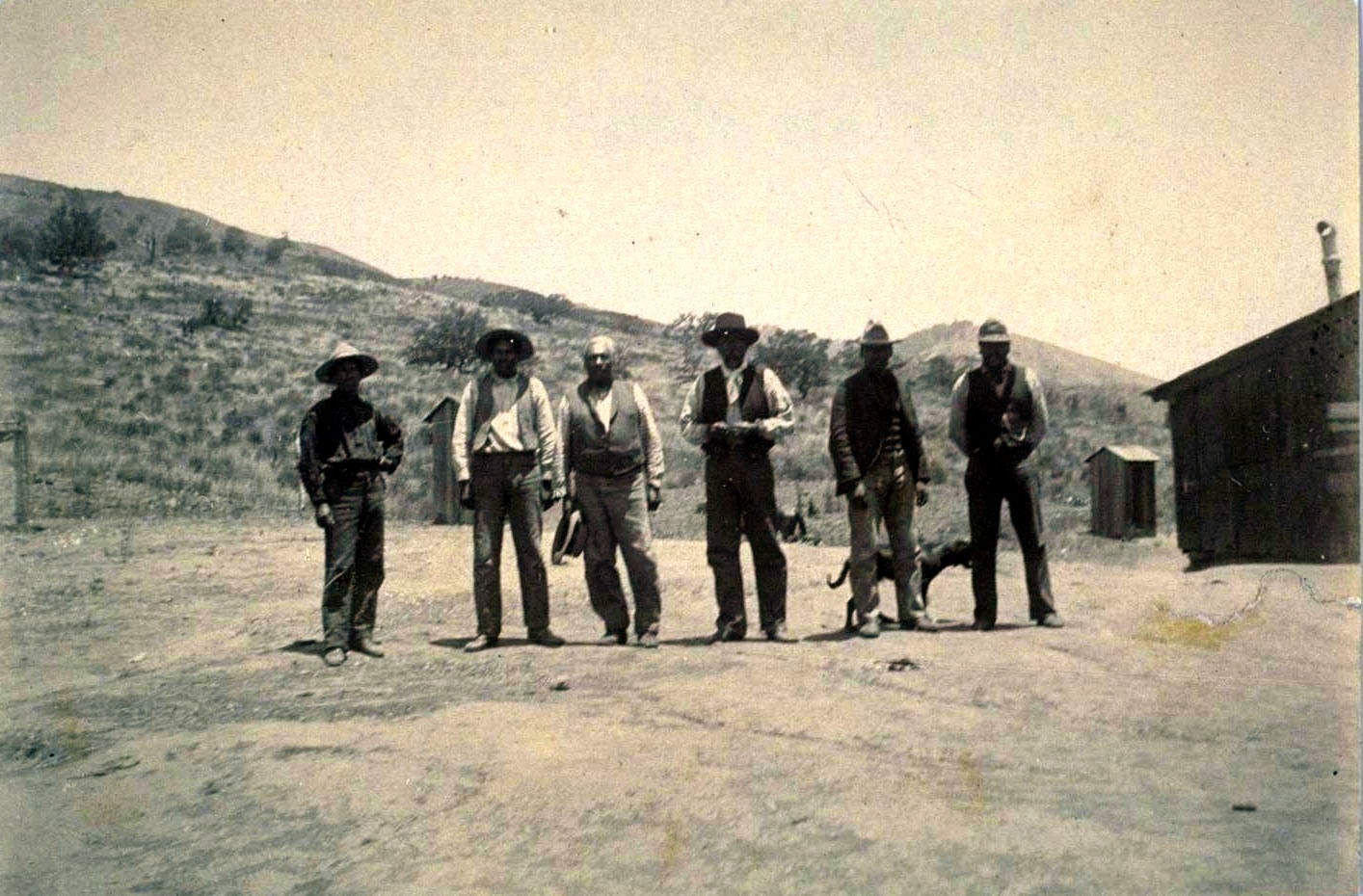
These stations were the only relief for the rigors of travel and the scenes of countless events of dramatic interest that have left numerous ghost stories; the ‘White Horse Ghost of Vallecito’, the ghosts of Texas emigrants Mr.’s Buck and Roland who shot it out to their deaths, and the ‘Lady Ghost’ or ‘White Lady of Vallecito’, and it is she that makes the vistor most uncomfortable.    


Buried in her wedding dress just below the station, they thought they had put her to rest but almost every night it is said she rises from her grave to walk the floors of Vallecito Station waiting for the stage to take her on to her lover in Sacramento and a marriage that never materialized. 


NO. 304 VALLECITO STAGE DEPOT (STATION) - A reconstruction (1934) of Vallecito Stage Station built in 1852 at the edge of the Great Colorado Desert. It was an important stop on the first official transcontinental route, serving the San Diego-San Antonio ('Jackass') mail line (1857-1859), the Butterfield Overland Stage Line, and the southern emigrant caravans.
Location: Vallecito Stage Station County Park, on
County Rd
S2 (P.M. 34.7), 3.7 mi NW of Agua Caliente Springs 32º58.543'N - 116º21.002'W


Though not one to believe in ghosts, there is something spooky about this place, and there is no wish to spend a night here alone.

The song 'Vallecito' came as part of the Southern Emigrant Trail project and here's a link to a video sample:

VALLECITO             © Radio Flier Music

Vallecito, little valley, your water tastes so fine
Salt grasses for the horses, cool shade from the pines

In the late 1850's when the Butterfield line was new
A young girl came from the East, for her fiancé so true
Up to the gold country diggings where he'd made a lucky find
Eileen O'Connor would meet her lover and there to be his bride

Vallecito, little valley, your water tastes so fine
Salt grasses for the horses, cool shade from the pines

Improper food and doubtful water and the desert took its toll
She was too weak for the hardship, Eileen had taken ill
When they finally reached the station she was carried from the stage
Sweet water of Vallecito could not this young girl save

Vallecito, little valley, your water tastes so fine
Salt grasses for the horses, cool shade from the pines

They found her wedding dress and her letters they would send
This lost daughter of the golden west had come to journey's end
In the moonlight you can see her, pacing the Vallecito night
Waiting for the stagecoach, the lady ghost in white

Vallecito, little valley, your water tastes so fine
Salt grasses for the horses, cool shade from the pines
It's a long and rugged journey, on the Southern Emigrant Trail
Your sweet water came too late, for the girl so young and frail

Tuesday, December 21, 2010

Box Canyon

June 22. 1993 San Diego County. Second landmark in a series of nine. A free standing landmark with a vista view of the canyon.
It could be said that the single most important event in the history of the Southern Emigrant Trail is the Mormon Battalion's widening of the gorge at Box Canyon, thus making the former trail the first road into Southern California. and allowing wagons to pass for the first time.

On their long march from Council Bluffs, Iowa over the course of almost one thousand five hundred miles and three years, the Mormon Battalion never engaged in battle and never fired a hostile shot. On January 29, 1847, ten days after they made their way through Box Canyon, they reached San Diego. Included among the men arriving in the small village of San Diego were four women, including 19 year old Melissa and child who had made the entire trip from Iowa to California.

A mountain peak near Kirkwood in the Eastern Sierras now honors the memory of Mormon pioneer Melissa Coray and the thousands of emigrant women who endured similar hardships in settling the West.

NO. 472 BOX CANYON - The old road, known as the Sonora, Colorado River, or Southern Emigrant Trail and later as the
Butterfield Overland Mail Route
, traversed Box Canyon just east of here. On January 19, 1847, the Mormon Battalion under the command of Lieutenant Colonel Philip St. G. Cooke, using hand tools, hewed a passage through the rocky walls of the narrow gorge for their wagons and opened the first road into Southern California.
Location: On
County Rd
S2 (P.M. 25.7), 8.6 mi S of
State Hwy
78, Anza-Borrego Desert State Park 33º00.909'N - 116º27.573'W

One of the things that was most striking in the research to write this song was the perseverance of Melissa and the Mormon Battalion, who, with minimal hand tools widened what was a ‘jackass trail’ enough to allow a 6’ by 9’ wagon to pass. The battalion recently losing many of their tools and supplies to the Colorado River when they crossed at Yuma further amplified the hardship. 

Here's a link to a video sample of the song 'Box Canyon'


BOX CANYON         © Radio Flier Music

The rocky walls of the narrow gorge is a place we call Box Canyon
Where only a mule or man could pass, before the Mormon Battalion
With ax and pick they hacked away 'twas too narrow for their wagons
1847 they made their way, and opened up Box Canyon

Chorus - On the wagon up so high she rode with her companion
Just like a ship through a canal, they sailed through Box Canyon

Melissa was the faithful wife of Sgt. William Coray
She wrote of her experience, this is Melissa's story

16 mules gave out today, it's our last 4 oz. of flour
8 wagons left from 37, this is our darkest hour
Even though the times are grim, our spirit is unbroken
And with the walls now chipped away, Box Canyon now is open

Chorus - On the wagon up so high she rode with her companion
Just like a ship through a canal, they sailed through Box Canyon
Get fiddle and bow and don't you know there'll be dancin' I must warn 'ya
It's a beautiful day we've paved the way, this trail to California
This trail to California

While we washed our clothes and cleaned our guns at Vallecito Creek
From a village nearby came an Indian that we were pleased to meet
He had a letter from San Diego, soon to be our destination
It was greetings to the Mormon Battalion, now it's time for celebration

Chorus - On the wagon up so high she rode with her companion
Just like a ship through a canal, they sailed through Box Canyon
Get fiddle and bow and don't you know there'll be dancin' I must warn 'ya
It's a beautiful day we've paved the way, this trail to California
This trail to California


Monday, December 20, 2010

Butterfield Stage

June 22, 1993 San Diego County CA
Third landmark of nine in the series of June 22
Spirits remain high, the day is still young and other than a growing need for some pie in Julian, things are rolling along this route loosely referred to as the Southern Emigrant Trail, and traveled by foot, mule, horse, jackass, wagon, car, and truck since the Spanish began following Native American trails.

This landmark has been visited twice, the reason being that there are two plaques; one on highway saying with a pointing arrow: “That-a-way”. And the second landmark plaque at the actual site, which in this case is down a dirt road and atop a hill overlooking the pass. The first time by these parts, credit was taken by just seeing the first plaque on the highway, but mounting guilt forced a return to the scene, to circle aimlessly through the dirt in four wheel drive, ruining the fragile ecosystem till the better half and daughter spotted the damn thing way up on the hillside. Ironically, this plaque location and attempt at humor from 1958 was performed by the Sierra Club. Another thing the Sierra Club did in their rush to celebrate the Butterfield Stage centennial with a landmark was to not name the pass, so though the name probably lies on a USGS map somewhere, it will now be named for my first pet, Dumbo.   

In 1858 John Butterfield won a government contract of $600,000 a year for six years to carry mail from Tipton Missouri to San Francisco twice a week. Spending more than a million dollars getting the company started, he and his 800 employees ran between 100 and 250 coaches, 1000 horses, and 500 mules. The 'Concord' coaches they used weighed about 2,500 pounds and cost $1,300.

The Butterfield Overland Mail Company initially followed a southern route between St. Louis and San Francisco that avoided the snow of the Rocky Mountains by traveling through Texas, the New Mexico Territory and Southern California. The trip of 2,900 miles was always made in twenty-four days or less.

Though the coaches had the mail as their first priority, they also accepted as passengers any hardy souls who were game for the adventure. Passage for the whole route cost $200, and a passenger was allowed twenty-five pounds of baggage. The coaches traveled twenty-four hours a day; there were no sleepover stops, only the hurried intervals at the station houses when they changed horses. Travelers were then offered meals of bread, coffee, cured meat and, on occasion, beans.
The song, ‘Butterfield Stage’ came out of this landmark and others in Riverside, Los Angeles, Kern, and Tulare counties and lyrics will follow in a blog soon to follow. In research a light-hearted list from the stage company posted in Tipton, Missouri told of what bring for the 24 day journey of a lifetime, and with some healthy exaggeration, a song took shape. Turns out this is a great way for kids to learn the names and terminology of clothing and artifacts in those days immediately preceding the civil war.
Here's a link to a video sample:  http://www.youtube.com/watch?v=gRUY91za0vk

Plaque inscription: NO.
647 BUTTERFIELD OVERLAND MAIL ROUTE
- This pass, Puerta, between the desert and the cooler valleys to the north, was used by the Mormon Battalion, Kearny's Army of the West, the Butterfield Overland Mail stages, and emigrants who eventually settled the West. The eroded scar on the left was the route of the Butterfield stages, 1858-1861. The road on the right served as a county road until recent years.
Location: Blair Valley, 0.5 mi E of
County Rd
S2 (P.M. 23.0), 5.8 mi S of
State Hwy
78, Anza-Borrego Desert State Park. Marker has been moved to hillside of East fork road off highway S2  .6 mi. 33'02'187N - 116'24'186W

Sunday, December 19, 2010

San Felipe Stage Station

June 22, 1993 San Diego County Fourth landmark of nine in the series of June 22nd.

Left out of the last blog was a link to the song 'Julian', here it is:
http://www.youtube.com/watch?v=BWog4VLaGU0


The San Felipe stage station lies seven miles from the Butterfield Mail Route landmark, when you ‘head ‘em off at the pass’, this is where you headed to.
In total, the landmarks seen on this day make a great tour. Weaving along county road S2 and highway 78, witnessing for real and for free (except for fuel) what folks wait in line at Disney California Adventures attempt, to sit in hanging chairs and watch a movie. Then again, does S2 need thousands of additional cars? Probably not, so let’s keep it a secret.

Records show a photo was taken of this piece-of-cake-to-get-to landmark but somehow was lost in the transition of print to digital scan. Film and developing costs to fuel the Canon AE-1 and its lenses were pricey in the day, so one did not go about randomly shooting extra photos. Composition was paramount and rare was the cell phone camera type shot of half arms and overexposed faces. Though not used in many years, that camera is still around with the counter at 14 and the question begs….’hmmm, wonder what’s on that roll’. At any rate, San Felipe Stage Station got a state plaque and the monument is of square-ish construction typical of its time of dedication, except they used whiter rock than usual.  

NO. 793 SAN FELIPE VALLEY AND STAGE STATION - Here the southern trail of explorers, trappers, soldiers, and emigrants crossed ancient trade routes of Kamia, Cahuilla, Diegueno, and Luiseño Indians. On the flat southwest across the creek, Warren F. Hall built and operated the San Felipe home station of the Butterfield Mail, which operated from 1858 to 1861. Later the station was used by Banning Stages and by the military during the Civil War.
Location: On County Hwy S2 (P.M. 15.9), 0.9 mi NW of intersection of State Hwy 78, near Anza-Borrego Desert State Park Coordinates: 33º06.112'N-116º29.038'W


Saturday, December 18, 2010

Julian

Julian
June 22, 1993 San Diego County CA
Coming from San Felipe stage station, the fifth of nine landmarks in the series, and gassing up the DeSoto at a pricey $1.17 a gallon.

‘Wow! It’s Idyllwild with apple trees’ – thoughts on first visit in 1968 with partners from childhood Steve and skinny Dennis. Sitting there on by a fence on the outskirts of town and fresh out of the USMC it was a chance encounter with the old mining town and not known that many trips would follow in return pilgrimage for autumn apple juice and pie.

Landmark inscription: NO. 412 JULIAN - Following the discovery of gold nearby during the winter of 1869-70, this valley became the commercial and social center of a thriving mining district. Ex-Confederate soldier Drury D. Batley laid out the town on his farmland and named it for his cousin and fellow native of Georgia, Michael S. Julian. By 1906 most mines were unprofitable. Since then the area has become more famous for the variety and quality of its apple crop.
Location: Private plaque: Julian Memorial Park, Washington and Fourth Sts, Julian State plaque: In front of Town Hall, Julian N 33° 04.703 W 116° 36.161


The song ‘Julian’ came out of the effort to create a song about each of the Southern California state landmarks that deal with mining…from Imperial up to Kern counties. Research on Julian presented the story of a Wells Fargo stage driver on the Julian to San Diego run and ‘The Case of the Lost Treasure Box’….the strongbox that held the gold. They were supposed to keep the box up front with the driver on the floorboard behind the dashboard. The dashboard was where you propped up your feet like Frisco pegs on a Harley, but the actual intent was to ‘dash’ away mud and rocks kicked up by the horses, and yes, that’s where the name dashboard in cars comes from. Our hapless driver felt the strongbox was in his way so he plopped it up on top of the coach where it popped off somewhere in route. Though the driver’s fate is unknown, I gave him a demotion and moved him to the Black Hills run in the Cargo Muchacho Mountains of the Imperial Valley, figuring it was as bad a route as you could get.

JULIAN          © Radio Flier Music

Oh lordy I’m in trouble, my spirit’s in a low degree
$10,000 gold in the strongbox, somehow I let it go free

I’m a Wells Fargo stage driver, running a four-horse team
From the Julian mines to San Diego, in 1873

Oh lordy I’m in trouble, my spirit’s in an low degree
‘The case of the lost treasure box’ gonna be the end of me

Turned around on my own back up the trail, hoped to find it there
I hired out a horse and sulky, but somebody beat me there

(Chorus) Thomas Davies is a Julian man and a Julian man is true
He found that gold and without being told, knew just what he’d do
Hitched up his team and took it to town and gave it to the agent man
Said to Mr. Lawrence “I’m Thomas Davies and I’m from Julian.”

“Here’s your gold your shiny gold, I want $10 for my time”
Mr. Lawrence said, “That’s pretty good, $10 sounds just fine.”

Mr. Davies said, “There’s a man on the trail, says he belongs to you
But one of your men on a horse and sulky, Wells Fargo would never do.”

(Chorus)

A few weeks later he went back to town, to collect his fee
Got a gold watch and chain worth $600, for his integrity

I’m still driving for Wells Fargo, but it’s the desert Black Hills run
Count my blessings and be thankful, they didn’t chase me off with a gun

(Chorus)

Friday, December 17, 2010

Chapel of Santa Ysabel

June 22, 1993 San Diego County, CA
Coming from Julian this was the sixth of nine landmarks in the series of June 22, and for the authentic feel of old Alta California, there’s just something about this free standing chapel along highway 79. A first impression has many factors, but for rolling up to a landmark the first time, a scenic road and easy approach really assist the mood, as did the little museum and gift shop.

The story for a future song from this writer would be the chapel bells; said to have been the oldest in California, dating back to 1723 and 1767, and stolen by some nimrod (or nimrods) in 1926, never to be seen again. The day after the theft Jose Maria Osuna found the clappers but kept them. They were returned in 1956. Today, a San Diego CSI would likely be taking a hard look at Jose no matter how much of a stand up guy he was in the day. The second question would be where did this little rural chapel get such fine old bells in the first place? Where the bells stood is an original carving by Steven Berardi called ‘Angel of the Lost Bells’ that was inspired by the search. To this day, hope remains there that the bells will return.
Plaque inscription: NO. 369 CHAPEL OF SANTA YSABEL (SITE OF) - The first mass at a site nearby was celebrated September 20, 1818 by Father Fernando Martin. By 1822, Santa Ysabel was an asistencia, or mission outpost, that had a chapel, a granary, several houses, a cemetery, and about 450 neophytes. After secularization in the 1830s, priestly visits became rare. When the roof caved in, after 1850, ramadas were erected against one wall and services were held there. Tradition asserts this site has been used for religious services since 1818. The present chapel was constructed in 1924.
Location: On
State Hwy
79 (P.M. 21.8), 1.4 mi N of Santa Ysabel  N 33° 07.847 W 116° 04.705