Tuesday, February 22, 2011

Old Mazeland School


Note: Like the preceding three dispatches, the Mazeland School was seen before ‘officially’ setting out to see all of California’s state landmarks in 1993, so it’s off to Orange County to put another duck in the row.


The Huffy makes all the difference. It’s August 1957 and the Schwinn’s replacement is a 3-speed wonder of bicycle engineering that opens up the region like never before for a 10 year old. South to the beach, northwest to Lions Drag Strip, or northeast to Knotts Berry Farm….all in handy reach on lightly traveled roads of the day. We’re headed to Knott’s out
Carson Street
which becomes Lincoln when we hit Orange County, then up Western to the west side of Knott’s Berry Farm and park with the other bikes and walk on to Ghost Town.


The good stuff required money yet there was still plenty to do, but all that comes to mind now was to watch Aunt Nellie play the hammer dulcimer or talk to the guy in the jail. Available funds were spent on sarsaparilla in the saloon, the only known source of the real thing. The famous chicken dinner was $2.25 then and though that doesn’t seem like much today, a 20 cent hamburger from a stand along the way to Knott’s was the better deal for lawn mowin’ money.


We’re supposed to have free access to all of California’s state landmarks, that’s how it’s written up. However, over time the physical world around these 1100 or so sites evolve and sometimes we’re simply shut out, legally or not, and it is especially frustrating when an actual landmark exists. Mazeland School sits in a remote corner of the park as a well maintained pantomime caricature of its old self, accessed through the main entrance…meaning ‘ya gots ta pay’. A way around entrance fees that block what is supposed to be free access to state landmarks that works in most instances is to recite Office of Historic Preservation code stating the fact and you’re only here to view the landmark and will be off property in fifteen minutes. It helps to carry camera gear, hand held gps, a clipboard, and a laptop…enough stuff to look official and that you couldn’t possibly enjoy yourself. If must travel light then make sure the one thing you carry is a clipboard, and on it should be photos and information about the landmark you intend to see. Though these methods are nearly fail safe and have saved hundreds of dollars amortized over 900 landmarks with state and national parks and museums, etc., a theme park is a different animal and you’re going against the ‘A’ team in security terms. Good luck.


Plaque inscription: NO. 729 OLD MAIZELAND SCHOOL (RIVERA SCHOOL) - Constructed in 1868, this was the first school in the Rivera District. It was previously located on
Shugg Lane
, now
Slauson Avenue
.
Location: Knott's Berry Farm,
8039 Beach Blvd, Buena Park
, Orange County
Google maps: 33.843375-118.000614


Sunday, February 13, 2011

S.S. Catalina


This boat had class, and yet a regular guy from Rialto could shed a nametag uniform for a sport coat and share the ambiance with a Bel Air millionaire at the fantail bar as the bow cracked the summer morning ocean mist to the halo of crystal blue sky and waters of Avalon Bay. It’s July, 1955 and we’re in the wheelhouse of the S.S. Catalina’s heyday. 


Toss some coins off the starboard side to the diving island kids, as the refrain from ‘Avalon’ plays in your head stepping on to steamer pier. Bunny hop the night away at the casino with an actual orchestra, hit the glass bottom boats, or off to the interior in search of buffalo in the round back tour bus, go to the bird park, or simply hoist a few at the Marlin. At three in the afternoon (4 for daylight savings) the S.S. Catalina’s earth shaking whistle calls everyone back for the return to the mainland. Though you could cross by flying boat, DC-3, or sail or powerboat, the Great White Steamer was built for the task of going to Avalon and nothing did it better.


Sadly, due to cost of operation and the need for more frequent daily crossings, the S.S. Catalina was taken out of service in 1975 and bought by Hymie Singer for $70,000 as a Valentine gift for his wife. Hymie bit off more than he could chew and the once elegant vessel fell to progressively worsening situations and left to rot in Ensenada Bay. It has since been demolished. Though the present day Catalina Express catamarans are marvels of efficiency and Commodore Class includes trail mix, cookie, and a drink, the brass, teak, and leather is missed…yeah, that boat had class.


Before ‘officially’ setting out to see all of California’s state landmarks in 1993, there were a dozen or so seen by chance or choice in earlier years. The S.S. Catalina is the third in this series of dispatches.   

If there was a plaque the inscription would read: Launched in 1924, built by Santa Catalina Island owner and chewing gum Magnate William Wrigley. She was used to transport passengers from Los Angeles to the island. During her working life she carried over 2.4 million passengers to and from Avalon Bay on Catalina Island.  Retired in 1975 and place on the National Register of Historic Places in 1976. CATALINA is registered as California State Historical Landmark No. 894 and City of Los Angeles Cultural Monument No. 213.

Location: Google maps: 33.344683 - 118.3264 for former site of ‘steamer pier’ in Avalon Bay.  Original location: Port of Los Angeles, Catalina Terminal, Berth 96.


The family has been trekking to Catalina for nearly 100 years and here are a few early shots from 1918. The ship at the steamer pier is unknown but possibly ‘The Hermosa’. When Wm. Wrigley bought the island he also bought the ‘Virginia’ or USS Blue Ridge and renamed it ‘The Avalon’, and later added the S.S. Catalina in 1924.


For the 1958 Four Preps hit ‘26 Miles’ the story was that Mr. Belland from the group was putting a song about Catalina together on a LA South Bay beach and asked someone walking by how far away the island was, "I dunno, about 26 miles".


For this writer, the island gets many visits in song; ‘Catalina’, ‘Day Old’, ‘S.S. Catalina’, ‘The Golf Cart Song’, ‘Charlotte’, ‘Great Avalon Fat Dog Contest’, ‘Tuna Club’, and ‘Avalon, I’m Coming Home’ are all about the experience.

Here’s a YouTube link for a video of the song:
http://www.youtube.com/watch?v=dbqz71zaSvg


S.S. CATALINA                   

Up the ramp, onboard the ship, leave the world behind

To a topside bench painted blue, out on the starboard side

Hands to your ears for the whistle blast, soon you’re on your way
Out to sea at 16 knots, could there be a better day?

Porpoises swim to the side as if to say hello
There’s flying fish and stranger things, they put on quite a show
The band plays by the dance floor, with drinks at the fantail bar
There’s lovers, friends and wide eyed kids and occasional movie stars

(Chorus) On the SS Catalina there’s so much to be seen
Come take a ride, leave cares aside on the ocean so serene
To the island of romance, won’t you come along?
On the SS Catalina, the pride of Avalon

William Wrigley had her built in 1924
2000 strong she’ll carry, to the Catalina shore
Past the grand Casino to the steamer pier on time
Over 20 million passengers she carried in her prime

Alas, her time has come and gone she sails the sea no more
But legend says there is a way, if you go to the Avalon shore
And listen close you’ll hear the ghost of her whistle everyday
At three o’clock she calls goodbye and sails on her way

Tuesday, February 8, 2011

Signal Hill - Alamitos No.1


August 15, 1954
The twenty inch two by four metal-wheeled skateboard aims down
Hill Street
from the Alamitos No.1 landmark towards certain doom.


Update!

Thanks to mention from Tim Grobaty at the Long Beach Press Telegram, the city of Signal Hill got hold of this blog and song and have now made a plaque out it to hang in the council chambers. Plaque begats plaque:


From the city:
This is the design we have drafted to showcase your song. It will be approx. 24” x 36” and will hang prominently in the council chamber. In February you sent me the song (see below), and indicated that it is in rough form and that you’re working on a CD and video. The song is great. It reminds me of the Woody Guthrie songs we listened to growing up. When/if this is completed, could we place it on our website? The city council may also like to show it at a council meeting. All with your permission, of course.

Rebecca Burleson
Assistant to the City Manager
City of Signal Hill

The Plaque:


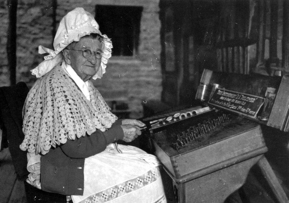
(family photo - 1952)

Shell Hill is now wussified into a divided affair with a landscaped meridian. For those of us who spent many an adrenaline drenched moment staging the latest vehicle at the landmark on the corner for the 300’ vertical descent down the 22% grade. Various lengths of lumber and/or plywood with roller skates or baby carriage wheels, trikes, bikes, and later cars were ridden down at velocities that almost always exceeded design limits. A ride down Shell Hill’s two stages usually meant a bailout at some point, though the Schwinn cruiser could make the complete ride…however, dental records say otherwise. This hill laughs at bicycle brakes. With the few ounces of common sense left in us, we knew enough to wrap and tie on old clothes for padding and lay a bandana inside our reversed baseball caps for helmets.  In the teen driving years we’d spool up speed by running the stop sign at the top and hit the hill at 60 to 70mph and get air….great fun as long as the car was aligned. Come to think of it, this hill could be the birth of straight line hot rodding since the Model T club began modifying speedsters and roadsters to ‘make the grade’ when Model T’s were new.


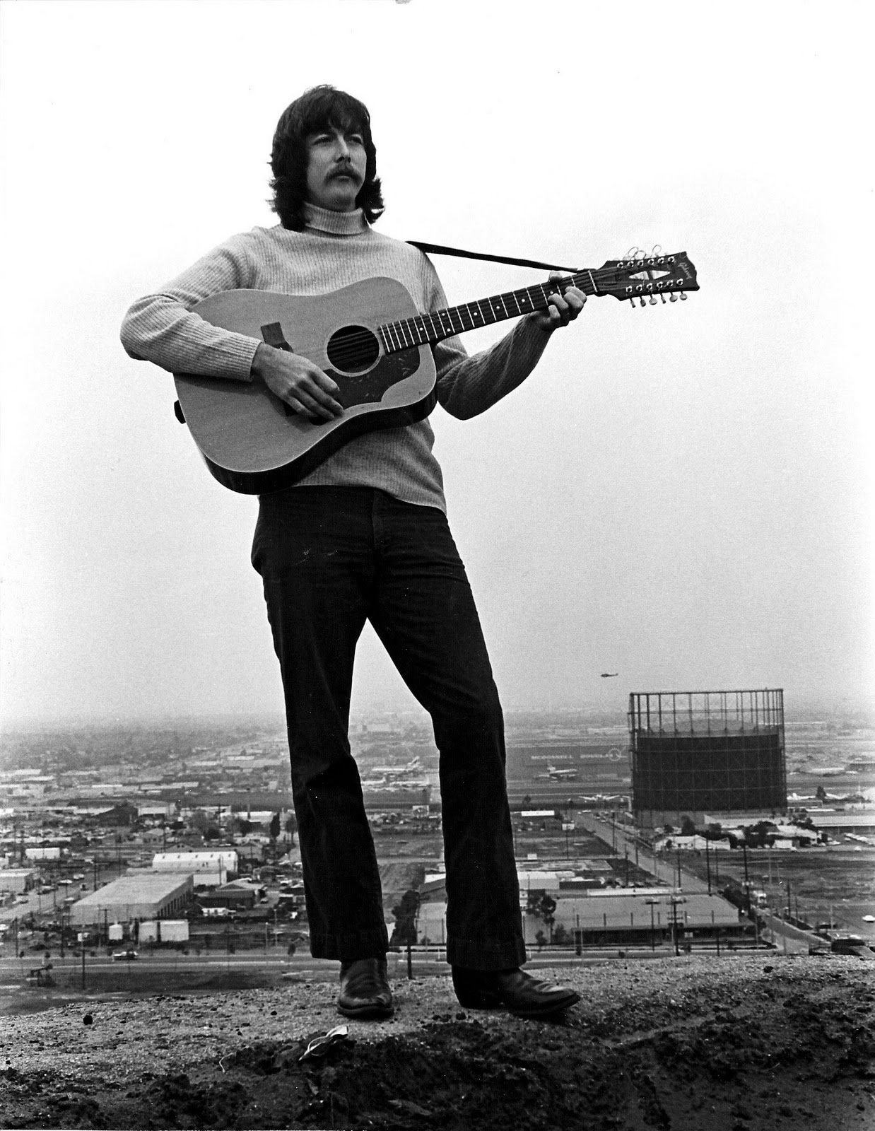
(yours truely - Signal Hill '73)

Though the road is now a sad fluff muffin of its former self, it remains the K2 of childhood dreams, along with the pleasant mix of winding dirt and paved roads where one could learn to drive properly amongst the discarded rigging clutter up to the top and the KNOB transmitter.


Shell Oil Company stuck with driller Frank Hays’ belief that the oil lay a fair amount deeper than earlier ‘dusters’ or attempts by other outfits, and it paid off in a California gusher the likes of which had never been seen before. Soon there were so many derricks they were calling it ‘porcupine hill’


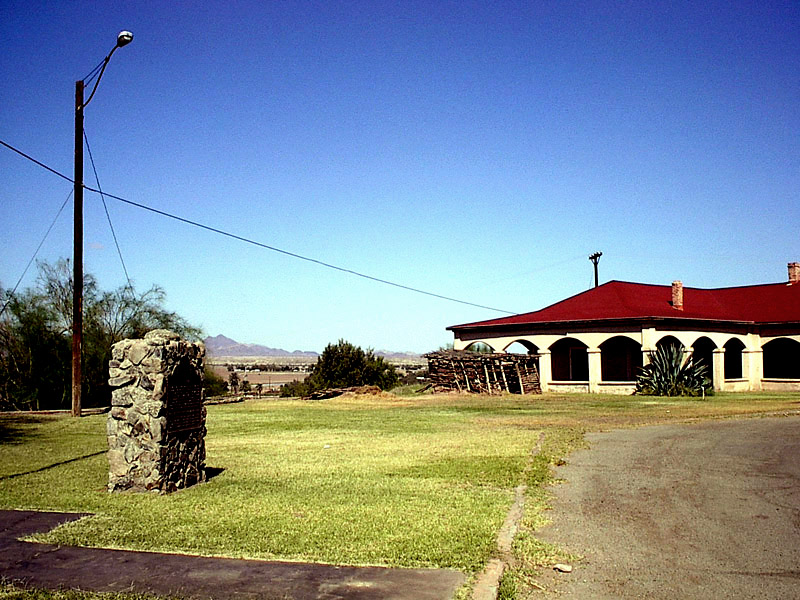
Plaque inscription: NO. 580 WELL, ALAMITOS 1 - One of the world's most famous wells. Started on March 23,1921, it flowed 590 barrels of oil a day when it was completed June 25, 1921, at a depth of 3,114 feet. This discovery well led to the development of one of the most productive oil fields in the world and helped to establish California as a major oil producing state.
Location: NE corner of

Temple Ave
and

Hill St
, Signal Hill
Google maps: 33.797222,-118.158809


SIGNAL HILL                      © Radio Flier Music

(Chorus) Signal Hill, Signal Hill
Black gold we’re gonna drill

Long before the white man, long before the drill
Indians sent smoke signals up on Signal Hill 
Up on Signal Hill 

Many feet it rises, three hundred sixty-five
And see the land for miles around when the oil men arrived
The oil men arrived

But early wells were dusters, oil they had none
Till Frank Hayes was heard to say in nineteen twenty-one
Nineteen twenty-one

“There’s oil in the soil” for Shell Oil he begun
To drill a little deeper, with Well number one
Alamitos number one

On the 23rd of June, 9:30 in the night
Alamitos one erupted, it was an awesome sight
What an awesome sight

A hundred feet the oil rose to the California sky
“I’m Signal Hill’s oil boom, to peaceful times good-bye”
Peaceful times good-bye

The hill looked like a porcupine, three hundred wells or more
Quarter million barrels a day, by nineteen twenty-four
Nineteen twenty-four

Though now the hill is going dry, it had a mighty run
Here’s to the men from Wilmington, and Alamitos one
Alamitos number one

Signal Hill, Signal Hill
Black gold we’re gonna drill


Monday, February 7, 2011

Yosemite Valley

The outline of this chronicle was to make at least a half-hearted attempt at putting these landmarks in the order they were visited. So, to clear up a few loose ends and account for ten landmarks visited before attempting to go to every state landmark became ‘offical’ in 1993, the clock goes back to 1950 and a warm August day in Yosemite Valley and the ‘first’ landmark. 

  
While walking about and looking for dear a bear comes from the woods for some face to face time and my mother abandons me for the safety of the car. Apparently my experience with large dogs in my first and previous three years prepared me for the situation and to stand my ground till my aunt came to the rescue…..at least that’s the family story. They say we can recall a precious few of the highlights of our first years…and this wasn’t one of them, just photos. Now Babe Didrikson latest golf conquest over the radio of the ’46 Chevy that day is another story.


(grandparents on Overhanging Rock - 1922)

(grandfather on Balancing Rock - 1922)


(Christmas day - 1922)

Father did his baby time here as the grandparents pulled up stakes in Long Beach to live and work here at Camp Curry. Year round Yosemite life in those days meant you rode out the winter in place and had God’s best handiwork to yourself.


Though they eventually returned to Long Beach, the memories of the valley planted the seeds that grew to a family presence in the San Jacinto Mountains near Idyllwild that remains today. From the deck of his mountain home, grandfather would recollect with Ansel Adams clarity how he’d toss the burning brush from atop Yosemite Falls, yet somehow at the same time be calling ‘Let the fire fall!” from below.  


NO. 790 YOSEMITE VALLEY - On June 30, 1864, in an act signed by President Abraham Lincoln, the United States granted the Yosemite Valley and the Mariposa Big Tree Grove to the State of California to 'be held for public use, resort, and recreation . . . inalienable for all time.' This, the first federal authorization to preserve scenic and scientific values for public benefit, was the basis for the later concept of state and national park systems. In 1906 the State of California returned the land, considered the first state park in the country, so that it could become part of Yosemite National Park.
Location: Mounted on entrance wall of auditorium bldg, Visitor Center, Yosemite National Park


Sunday, February 6, 2011

Fort Yuma

Crossing Imperial County – Stop 15 


So here it is, 246 miles and in theory roughly ten hours to go to the 15 state landmarks of Imperial County as we reach the end of the eastbound line at Ft. Yuma. From 1892 to today the fort has been part of the 45,000 acre Quechan Reservation and has provided a variety of services in that time. Hungry? Tacos Mi Ranchito on 4th in Yuma AZ is less than a mile away.


From the album ‘Landmarks of Imperial County’:
It was also called Camp Independence for a brief time before becoming Camp Yuma.  Of note was that it never had walls and was more of a barracks than a Fort, with the purpose of defending the Yuma crossing, providing military protection for wagon trains and attempting to control the Yuma Indians within a 100 mile area.  As many as 60,000 emigrants crossed the Colorado River at Fort Yuma in 1851. 


As the hottest Army post in the country, they used thick sun dried brick walls with double wooden roofs and covered sentry walkways to lessen the heat's effect, yet many soldiers were ill prepared for this duty and died from complications of heat stroke and exhaustion. In mid summer the soldiers had no duties and would attempt to sleep after midnight on the rooftops.


Plaque Inscription: State Historical Landmark No. 806 FORT YUMA Originally called Camp Calhoun, the site was first used as a U.S. military post in 1849. A fire destroyed the original buildings. By 1855 the barracks had been rebuilt. Called Camp Yuma in 1852, it became Fort Yuma after reconstruction. Transferred to the Department of the Interior and the Quechan Indian Tribe in 1884, it became a boarding school operated by the Catholic Church until 1900.


Location: On bank of Colorado River,
350 Picacho Road
, Winterhaven
Google maps: 32.730613,-114.615523
    

FORT YUMA                                    © Radio Flier Music

Chorus - Aye yi, Fort Yuma, Fort Yuma we've come a long way
Aye yi, Fort Yuma, we make Fort Yuma today

From the Mountains Springs grade we made Desert Tower
And drank at the Yuha well
We rested a time at Camp Salvation
And visited Ft. Pacheco

Then we moved on to dance at the Rancho
And down the
Old Plank Road
Then off to see Camp Pilot Knob
Oh the things this Valley has known

We saw the sculptures of Driftwood Charley
And went to a couple of mines
Some trails were short some took forever
 Fort Yuma the trail will wind

We saw the place in 1540
The search for the cities of gold
We then learned the fate of those two missions
It's been an adventurous road

Fort Yuma's so hot there's the tale of the soldier
Who died and went down to hell
But he came back to pick up some blankets
To lessen the devilish chill

Saturday, February 5, 2011

Two Missions

Crossing Imperial County – Stops 13 & 14


The Spanish took the high ground for these two missions for the Colorado River in its untethered days would flood vast reaches of land. Unlike the coastal ‘successes’ and subjects of countless California fourth grader mission models, the Quechan people refused to be subjugated in the same manner and destroyed both in a coordinated attack.  


Plaque Inscription: SHL 921 SITE OF MISSION SAN PEDRO Y SAN PABLO DE BICUNER
To protect the Anza Trail where it forded the Colorado River, the Spanish founded a pueblo and mission nearby on January 7, 1781. Threatened with the loss of their land, the Quechans (Yumas) attacked this strategic settlement on July 17, 1781. The Quechan victory closed this crossing and seriously crippled future communications between upper California and Mexico.


Location: On County Road S24, 0.2 miles West of intersection of Levee and Mehring Roads, 4.4 miles NE of Bard. Google maps: 32.816656,-114.517117
Mission San Pedro is 19 miles from Hernando de Alarcon

A suggestion while roaming about this area would be to head west from landmark #921 on
Mehring Road
then south on York to the Imperial Date Gardens about a mile and a half away for friendly staff and a date shake.


Next is the drive to the Ft. Yuma site at the Yuma crossing and the location of our second mission. The structure here is the St. Thomas Indian Church, and white plaster and panorama take one away to an earlier place and time. Add to this a wedding is in progress, with embroidered white cotton with the men in guayabera shirts. It was a perfect time to drop by.   


Plaque Inscription: SHL 350  MISSION LA PURÍSIMA CONCEPCIÓN (SITE OF)
In October 1780, Father Francisco Garcés and companions began Mission La Purísima Concepción. The mission/pueblo site was inadequately supported. Colonists ignored Indian rights, usurped the best lands, and destroyed Indian crops. Completely frustrated and disappointed, the Quechans (Yumas) and their allies destroyed Concepción on July 17-19, 1781.


Location:  St. Thomas Indian Mission, Indian Hill on Picacho Rd, Fort Yuma, 1 miles South of Winterhaven
Google maps: 32.730523,-114.615791
Mission La Purisima is 12 miles from Mission San Pedro


Here’s a link to a video sample of the spoken song ‘Two Missions’


TWO MISSIONS        © Radio Flier Music

This is a story of the Quechan or Yuma Indians and the two Spanish missions in the Imperial Valley many years ago.

The Indians were farmers and had cultivated the lands along the Colorado River for many years.  The Spanish came and were to build two pueblo style missions unlike the large and fortified missions along the coast.  At first the relationship between the Indians and Spanish was good, and for a time things were peaceful.

Soldiers and their families and settlers and priests along with livestock came and the Indians could no longer settle where they wanted.  Certain lands were reserved for the Spaniards.  Also, it was a dry year and there was a shortage of food.

Lieutenant Fernando Rivera who went to defend the two settlements sent many of the pioneers back to the coast but the livestock remained.  Hundreds of head of cattle, horses, and sheep were allowed to graze on the Indian's crops.

Finally, on July 17th 1781 the Quechan attacked and destroyed the tiny settlements, killed Rivera, beat four missionaries to death with war clubs, and killed many Spanish soldiers.

As a result of the Yuma revolt of 1781 the Anza trail was closed. Colonists would have to go north in crowded packet boats across the Sea of Cortez. 

And the desert was quiet
 

Friday, February 4, 2011

Picacho Mine

Crossing Imperial County – Stop #12


“I hate this road, I hate this road” the better half kept repeating as we made our way up the eighteen mile dirt road stretch to the Picacho Mine. To this statement the argument was made on my part that there is no nobler cause than setting an objective and reaching it, regardless of cost, but the 117 degree heat and being late for duties at home was making for a pitiful defense and the conversation evolved to “I hate this road” “We can’t turn back now” “I hate this road” “We can’t turn back now.” Upon arrival and a few photos one comes to the realization that the return trip  is also eighteen miles and it’s still 117.

In truth it is in fact a very drivable dirt road that eventually leads to the landmark located to the right of the fenced in and as of 2002, closed Picacho mine where modern day miners were ferried in 15 passenger vans to the site. However, when compared to the hunt for most other state landmarks and using diving metaphor, this would be an inward 1½ somersault with 2 Twists with a degree of difficulty of 3.1


Since the 1872 mining law that allowed open pit mining on federal lands there has been conflict with Native Americans who feel the land is sacred and the landscape their cathedral. Recent legislation has made the government more sensitive to the issue and future permits will be more difficult to obtain.

Plaque Inscription: State Historical Landmark No. 193 PICACHO MINES Opened by placer miners after 1852, the gold mines expanded into hard rock quarrying by 1872. Picacho employed 700 miners at its peak from 1895 to 1900. Mill accidents, low ore quality, and the loss of cheap river transport with the building of Laguna Dam led to numerous periods of inactivity. With ores far from worked out, the Picacho Mines, using modern techniques, again resumed operations in 1984.

Location:  On
Picacho Road
, 18.2 miles Nort of Winterhaven
Google maps: 32.966835,-114.636325
Pacacho Mine is 26 hang unto you hat, one way miles from Charley’s Lost Art


Here’s a link to a video sample of the song:


PICACHO MINE

Oh I hate this road I hate this road
Please do not make me go
Everyday in this mining crew
Who made it I don't know

Eighteen miles from nowhere
And to nowhere it does wind
Eighteen miles of treachery
To reach Picacho mine

Chorus - So long goodbye a fond farewell, adios, I'll never miss you
Your all worn out and all closed down, you're no longer an issue
Two centuries been diggin here, it's over now this time
Toodle-loo  I won't miss you, goodbye Picacho mine

Oh I hate this road I hate this road
Please do not make me go
Ain't no good ore left out here
Value's gone too low

We've tried every trick there is
With drills and cyanide
No more to get from this open pit
Called Picacho mine

Oh I hate this road I hate this road
Please do not make me go
This is my last day workin' here
My last swing shift you know

Give back my tools when I get my check
From the Glamis company
They're closing you in 2002
A happy day for me

Thursday, February 3, 2011

Hernando de Alarcon

Crossing Imperial County – Stop #11


Just up the road from driftwood Charley’s diggings is the Hernando do Alarcon landmark. Pushing the limits of oceanic exploration in 1540, he became the first dude from Yurrup in these parts.


From the album ‘Landmarks of Imperial County’
Though he never connected with the Coronodo expedition at the appointed location, Hernando de Alarcon's mission was hardly a failure.  He proved that Baja California was a peninsula and not an island and brought accurate maps back to Spain in 1541, and discovered the Colorado River.  After going nearly 100 miles up his new discovery and before returning to Spain, he left letters for Coronodo.  Another explorer, Melchior Diaz later picked them up after the Quechan Indians were heard to say, "You've got mail."


Plaque Inscription: State Historical Landmark No. 568 HERNANDO DE ALARCON EXPEDITION, 1540  Alarcon's mission was to provide supplies for Francisco Coronado's expedition in search of the fabled seven cities of Cibola. The Spaniards led by Hernando De Alarcon ascended the Colorado River by boat from the Gulf of California past this point, thereby becoming the first non-indians to sight Alta California on September 5, 1540.


Location: On
Algondes Road
, Hwy 186 (PM 0.4), 0.5 miles South of I-8, 0.4 miles North of Andrade border, Andrade.
Google maps: 32.737977,-114.717865
Hernando is 26 miles from Picacho Mine and best seen prior, along with Pilot Knob.


Here’s a link to a video sample of the song:

Lots of milage a-phayin' this taliking blues to tour groups. 

HERNANDO de ALARCON

To imagine this river in 1540 is a pretty hard thing to do
That's the year the Alarcon expedition went on a little river cruise
Sailed up the gulf three ships afloat up from Mexico
Was gonna meet up with Coronado and find the Seven Cities of Gold
(Story was, there was gold lyin’ all around the whole place)

Now the Seven Cites of Gold they thought was kind of like paradise
Jewels and gold and silver, a feast for a Spaniard's eyes
For years they'd search for the king and church, looked everywhere it seemed
But the Seven Cites of Gold was a myth, a Spanish explorer's dream.
(Somebady just made it up)

The great Colorado River was a real tough river to ford
Wild and mean, wouldn't stay in place except for one little gorge
For in the mountains you'd hit the rapids and they would send you tossing
There was only one safe place to go and that was the Yuma crossing.
(Yuma........’nuff said)

On a day in May they made their way and the day of course was sunny
With armor plates and hats of tin, to the Indians they looked funny
Well Alarcon to Indians said "Have you seen Coronado?"
They said "No, but if you come back later, try out our casino."
(Come back in about 460 years)

Alarcon gave up and left a note and floated back to Spain
They never found those cities of gold but wait, lets look again
There's Cocopah casino, Viejas and Paradise I'm told
Spa, Morongo all rise out of the desert looking like cities of gold
(Who knew)

Hernando de Alarcon his mission did one thing
First to this part of California, from Europe you could sing
Hernando you're not a failure don't hang your head in gloom
No fortunes found they're not around you just arrived too soon