Old
Stovepipe Wells

I awoke in
the back seat of the Bel Air to find I was the last one up for mom and dad were
already outside the tent cabin having breakfast and talking to Dave Frey the
proprietor. I quickly performed my duty of winding the Chevy's clock (30 turns,
no more) and made for the outhouse (a fancy two hole-er). Inside the cabin tent
was an old windup Victrola and to play on it Dave had brought by a 78 of Vaughn
Monroe doing Ghost Riders in the Sky to help get us all in the mood to see that
song's author Stan Jones over in Furnace Creek later on. I played it again and
again, almost getting two plays out of a windup.

Mom seen
cooking while Dave turns about for the photo.
Dad and
Dave continued to hit it off well and were in total agreement about how much
'walkin' around money' a man needs. Not the cash in your wallet but front
pocket tender to keep at the ready. Then they returned to the subject of the
landmarks we were going to and Dave gave us new directions and a short cut to
Old Stovepipe Wells nearby, noting that we'd be walking part of the way due to
sand. Also, he said we should drop the landmark endeavor for a few hours and go
to Scotty's Castle for it was well worth the trip.

All packed
up, we gave a wave to good old Dave and said goodbye to the little resort of
Stovepipe Wells.

The
stovepipe well. You have to cross the mesquite dunes to get to it and after a
spell on the dirt road that came to a washout, and with our recent experience
of getting stuck in these same sands, the Bel Air stayed put and we walked. Mom
turned back after a few hundred yards, a few more Chesterfields
The words
made the desert scorching hot on that cool day as we continued across the faux
burning sands with no provisions whatsoever. For me that meant the 1950's standard
boys equivalent to civil war hard tack; a PPJ on Wonder Bread and a 6 ounce
Coke, stuffed in jeans back pockets.

Over and
over dad sang: 'All day I face the barren waste without the taste of water,
Cool water.
Old Dan and I with throats burned dry and souls that cry for water,
Cool water.'
Cool water.
Old Dan and I with throats burned dry and souls that cry for water,
Cool water.'

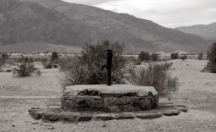
By the time
we arrived the song had the 60 degree morning feeling more like 120 and my
visions of pools of bubbling artesian wells were dashed as we found nothing but
a rock and cement base with a pipe sticking out of it. Dad made the best out it
and to perk me up told me how that method of marking spots in the desert helped
grandfather cross on the old plank road many years prior. With two way traffic
on eight foot wide wood planks over sand dunes they'd put up 4x4 lumber real
high to mark the turnouts. After figuring out that you could tell time by the
pipe's shadow, we returned to find mom engrossed in Cat on a Hot Tin Roof, just
out in print.
In reality
the water at Stovepipe Well was never pleasant, here's one prospector's
account:
"My canteens were exhausted when I arrived there [old Stovepipe
Wells], and I disregarded the admonition and drank. The water is very low in
the spring, is of a yellowish appearance and intensely nauseating in taste. Its
odor is very disagreeable, and it can be smelled for half a mile away.
Nevertheless, I filled my canteens, and drank of it while there. As I proceeded
on my journey my legs became unsteady and I found it difficult to continue my
usual pace. I lay down thinking to gain strength, but no improvement was
noticeable. The distance between Stove Pipe and Hole-in-the-Rock is about 14
miles, and I fully realized that it was by all odds a case of make this or die
. . . . I struggled forward, my legs becoming more and more uncertain…"

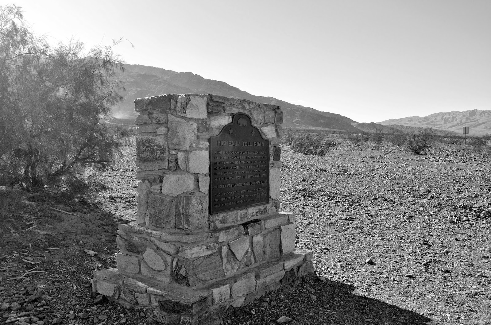
NO. 826:
Old Stovepipe Wells
Plaque
inscription: This waterhole, the only one in the sand dune area of Death Valley , was at the junction of the two Indian
trails. During the bonanza days of Rhyolite and Skidoo, it was the only known
water source on the cross-valley road. When sand obscured the spot, a length of
stovepipe was inserted as a marker.
From State
Hwy 190 (P.M. 92.1) go N 2.8 mi on (unpaved) Sand Dunes Access Rd, 6.1 mi E of
Stovepipe Wells, Death Valley National Monument