Thursday, January 12, 2012

Pioneer Odd Fellows


Photo of the more appealing Snoeshoe Thompson Monument


Alpine County August 4, 2009

With this landmark we bid farewell to Alpine County and five of the six state landmarks within….gonna get to Ebbetts Pass (the 6th) someday down the line. In retrospect, Ebbetts Pass not being down the line is the reason it was pushed to the way-back of the station wagon. You see, most everything around here of historical significance deals with trying to get out of here one way or another, and puts us on the route of many names; Carson Pass, Route 88, 1862 toll road, Amador/Nevada Wagon Road, etc. Unlike its other two lane brethren that cross the Sierra, 88 stays open year round, except for extreme snowstorms, and is the alternate to US 50 when it closes due to avalanche or flood. From the time of the Pioneer Odd Fellows inscribing their names here in 1849 till 1869 when the Transcontinental Railroad was completed, this was the equivalent of Interstate 80.


On January 3, 1944 this site was designated California Historical Landmark #378 for the simple reason that some guys inscribed their names on a rock in the pass nearly 100 years prior. Bigger things have happened. It’s confusing, for it isn’t as if these were the first Odd Fellows to California, a lodge was already established.    


Who are the Odd Fellows? Well, an unofficial mission statement would go like this: ‘Independent Order of Odd Fellows aims to provide a framework that promotes personal and social development. Lodge activities aim to improve and elevate every person to a higher, nobler plane; to extend sympathy and aid to those in need, making their burdens lighter, and to be a great moral power and influence for the good of humanity.’ The boys at E Clampus Vitus on the other hand, who likely put this landmark on the map, profess absolutely none of that.


Plaque inscription: NO. 378 MEMORIAL TO PIONEER ODD FELLOWS - On some large rocks near Carson Pass, a group of pioneers inscribed their names and the emblem of the Independent Order of Odd Fellows in 1849.
Location:  On State Hwy 88 (P.M. 5.3), 14.4 mi W of Woodfords
GPS 38.692184,-119.986008

Friday, January 6, 2012

Kit Carson Marker


Kit Carson

Alpine County August 4, 2009

From the Old Emigrant Road marker we head east on highway 88 for three miles. It was this route Kit Carson had picked using information obtained from Washoe Indians to guide the Fremont expedition out of Nevada and over the Sierra to Sutter’s Fort in winter conditions in early 1844. And sure enough, as the Washoe had warned, there was no food or game along the way the they had to resort to eating some of their dogs, horses, and mules.

'Kit Carson Marker' actually denotes the spot he carved his name on a tree.


John C. Fremont

There’s a pastoral place in Snake Valley, Utah named Pruess Lake, not for the hybrid Toyota but for Charles Preuss, the melancholy ‘old guy’ cartographer on the Fremont expeditions. While it seems as if everything in sight was either named Carson or Fremont from these early expeditions, the best Mr. Preuss could get was that small body of water in rural Utah…and misspelled at that.


Charles Preuss

As well as being a mapmaker, Preuss was an artist, and the illustrations he made of the expeditions were engraved and accompanied the published reports, for just like Facebook or a blog, it’s simply better with pictures. The maps and guidebooks from the expeditions became best sellers and helped the country expand to the Pacific. But again, all Preuss got out of it was temporary employment.


It was a bit like a serial western, with Fremont as the heroic Lone Ranger and Kit Carson as Tonto, his trusty sidekick. And then there was Preuss as the grumbling tenderfoot they needed to bring along.


To that trio of main characters, Fremont hired a group of cherry-picked civilians that were French-Canadian and American, seasoned hunters and trappers that could endure the hardships without complaint. Just about all of them were illiterate, so written record of the goings on were confined to Fremont’s notes and Preuss, who kept a diary for his wife. Biographers had to rely on Fremont field notes which were remembered and often enhanced after the fact, for the existence of Preuss’ notes were unknown. It turned out they had remained in his family and were found in the early 1930’s in his native Germany after a derivative ‘memoirs of a northern California pioneer’ was published. Attempts to retrieve the notes came to a halt with Hitler coming to power and eventually they were found in the American Memorial Library in Berlin in the 1950’s.


As it turned out the notes were mostly complaints about food and long hours in the saddle, along with tart observations of Fremont’s leadership and decision-making process. When combined with Fremont’s notes however, a good account of the first three of the four expeditions can be had. Preuss diary also exposes his weltschmertz;  that unique German word meaning roughly a growing world-weary sadness. That sadness eventually got to Charles Preuss and he committed suicide in 1854 at the age of 51.


The fold out from the 1845 report showing the 1844 route of the winter crossing of the Sierra Nevada. It begins on the East Fork of the Carson River near Markleeville, Ca (on the right) and ends at Sutter's Fort at New Helvetia (Sacramento) near the American and Sacramento Rivers.

Plaque inscription: NO. 315 KIT CARSON MARKER - On this spot, the summit of the Kit Carson Pass, stood the Kit Carson Tree on which the famous scout Kit Carson inscribed his name in 1844 when he guided the then Captain John C. Frémont, head of a government exploring expedition, over the Sierra Nevada. The original inscription was cut from the tree in 1888 and is now in Sutter's Fort, Sacramento.
Location:  On State Hwy 88 (P.M. 5.2), 14.5 mi W of Woodfords
GPS 38.694889,-119.989007

Tuesday, January 3, 2012

Old Emigrant Road


Alpine County August 4, 2009
From Coulterville in Mariposa County we’re going to magically skip across Tuolumne County 125 miles to the winding scenic landscape viewed from state highway 88 in Alpine County. When formed in 1864, Alpine County had a population of 11,000, due to the Comstock rush, but today is reduced to a tenth of that, and like Mariposa, has no incorporated cities. Additionally, Alpinians have no traffic lights, no college, no high school, no fast food, no gas stations, no theatres, no convenience stores, no dentist, no supermarkets,no banks, and no ATM’s. In other words, you might consider being self contained when you come here 

Also apparently missing is the Old Emigrant Road plaque that we’re headed to. Dedicated on November 5, 1958, it stood by the highway telling passers by of the path to Placerville till some road agent of questionable ethic made off with it the spring of 2011. Sadly, unless there is local effort and financing, it will not be replaced, for even when economic times were good, the state has shown little interest in maintenance or replacement..


For a time, this was the most popular route over the Sierra Nevada range with 120,000 people passing through from 1849 to 1852. And later in 1859 there was a second run when silver was discovered in Virginia City.

Originally the improved route came to be when the Mormon Battalion on their return to Utah sought an alternate to the Truckee River Route the Donner party used. The earliest white explorers through the region included all-stars Jedediah Smith and Joseph Walker, but it was John Fremont and Kit Carson, in their famous midwinter trip across Alpine County and the Sierra Nevada in 1844 that brought attention to possible travel routes across the range. Since it was Alta California at the time, you could say these explorers were immigrants and not emigrants.


Plaque inscription: NO. 661 OLD EMIGRANT ROAD - Here the Old Emigrant Road of 1848 swung down across the meadow now covered by Caples Lake (Twin Lakes) and climbed along the ridge at the right to the gap at the head of the valley. From this summit (9,460 feet) it descended to Placerville. This rough and circuitous section became obsolete in 1863 when a better route was blasted out of the face of the cliff at Carson Spur.
Location:  Lake Caples, on State Hwy 88 (P.M. 2.4), 173 mi W of Woodfords
GPS 38.706699,-120.043847
Marker not well displayed but great view of lake.  No G-13 500' apporoach signs.

Wednesday, December 21, 2011

Coulterville


Mariposa County – August 25, 2009

From the Hornitos (landmark #333) we backtrack and go up Highway 49 which they’re calling around these parts the ‘Golden Chain Highway  fifty two miles to the gold rush town and commerce center of Coulterville. You can easily walk the old town area, and check out the Chinese store (Sun Wo Col), tour the Hotel Jeffery, and cap things off with a sarsaparilla at the Magnolia; where patrons have been passing through those swinging doors since 1851.


Inside the Magnolia


You don’t really notice it at first, but they’ve buried the utilities here and that helps preserve the look of the many old structures still standing. Like clockwork, the town burned down three times, always in July and always twenty years apart; in 1859, 1879, and 1899.

It was after the 1899 fire that the ‘Gold Rush of 1899’ came. The story was that one of the residents had hidden his gold coins in the walls of one of the structures that burned and after that rubble was used for potholes in the streets, winter rains began uncovering the coins. The rush was on and the streets were soon impassible.


Coulterville had a lot going for it, not the least of which was its crossroads location and proximity to other towns, mines, and camps, making it a natural center for commerce. That’s what brought George Coulter and family here in the first place. Also, after placer mining faded out Coulterville got a second boost by the fact it sat on huge deposits of gold baring quartz, and that hard rock mining yielded gold for years to come.


Coulter built a hotel to accommodate the new traffic and came up with an ingenious water system for it consisting of a pump driven by a flywheel that was forty feet around and had a two foot rim. He then trained he two black Newfoundland dogs operate it by running inside the wheel, and when the water tank became full, the wheel stopped automatically and the dogs were free to resume duties and waiters and bellhops. Note to patrons: ‘Go easy on the bathwater;.  

This is the last dispatch for Mariposa County as we’ve already covered Yosemite Valley early on and all that remains is Savage Trading Post, which will hopefully be visited sometime down the line as part of a sweep of gold country’s landmarks that have been passed by on previous trips. So long, butterfly.


Plaque inscription: NO. 332 COULTERVILLE (S)- George W. Coulter started a tent store here in early 1850 to supply the hundreds of miners working the rich placers of Maxwell, Boneyard, and Black Creeks. He also built the first hotel, water for it was pumped from a well by two Newfoundland dogs. Originally called Banderita from the flag flying over Coulter's store, the settlement became Maxwell Creek when the post office was established in 1853, but the name was changed the following year to honor Coulter. The family of Francisco Bruschi, who erected the first permanent building here, provided the town's leading merchants for over eighty years. Despite their crude methods, and with only wood for fuel, the nearby quartz mines operated for years and produced millions of dollars worth of gold, Andrew Goss built the first stamp mill for crushing their ore.
Location: 5004 Main St. Coulterville, 95311 County Park, NE corner of intersection of County Hwy J20 and State Hwy 132 (P.M. 44.8), Coulterville N 37° 42.684 W 120° 11.853 Marker is at the intersection of State 49 and Main Street, on the right when traveling south on 49.
GPS: 37.710307,-120.197017

Saturday, December 17, 2011

Hornitos


Mariposa County – August 25, 2009


We leave 
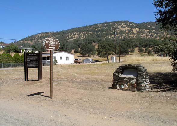
Bear Valley for a nineteen mile run down Bear Valley Road to Hornitos, population seventy five. Hmmm, that sounds like the opening act for Los Lonely Boys on the casino circuit.


These little valleys and low spots on the western slope of the Sierra can get rather toasty on a summer day (about 102 degrees on this one), but its name ‘little ovens’ came from the bake oven shape of its tombstones.

Most gold rush mining towns and villages with their matchstick construction burned to the ground and for some, several times over. Hornitos however is a bit different because they used a lot of adobe and stone in their buildings, for instance, the walls of the jail are two feet thick. Why? The town was built like a typical Mexican village by inhabitants that came here from other nearby camps and towns for being 'undesirable'....for their ethnicity.


At first, Hornitos was as wild as any other mining town with streets lined with bars, gambling dens, and houses of ill repute, but eventually they settled in and town folk desiring law and order even incorporated the settlement...the only town in Mariposa County to ever do so and that's the reason it became a state landmark.


The infamous bandit/folk hero Joaquin Murieta was almost captured here in the early 1850’s but slipped away. Though the official line is that Murieta was eventually caught, killed, and his severed head paraded about the state, many people thought it was faked and that he retired from his Robin Hood’ish ways to live off riches he’d stashed away. One version of that story puts Hornitos as the place he buried his gold. Joaquin Murieta was the basis for the fictional character of Zorro, and for a song ‘Joaquin Rides Again’ by yours truly, and part of the album ‘Hangtown Fry’ coming out on Blue Night Records in January 2012. Here’s the lyrics:

JOAQUIN RIDES AGAIN              
In a dusty Spanish pueblo, where the heat drives you insane
Lived the bravest man around, Murietta was his name
In the evening air he would disappear, and become the poor man’s friend
He’ll come to fight and it would be all right, when Joaquin rides again

In early California, where the forty-niners came
The lands in the hands of the white man, and the brown man has no name
But the wealthy few will always lose, when he is in command
Hang on tight; it’ll be all right, when Joaquin rides again

(Chorus) From the sky at midnight,
To an outlaw’s moon well sing this tune, when Joaquin rides again 

He’ll come down from the mountain he’ll come from the river shore
He’ll be in the hearts of free men, and even up the score
He’ll be the liberator, and put troubles on the mend
Hang on tight it’ll be all right when Joaquin rides again

From the mining camps and valleys from the hillsides to the sea
He’ll be asking one lone question won’t you ride with me
For all of California, he’s got a hand to lend
He’s come to fight it’ll be all right, when Joaquin rides again


Plaque inscription: NO. 333 HORNITOS (no plaque)- Hornitos, 'little ovens,' derived its name from the presence of many old Mexican stone graves or tombs built in the shape of little square bake ovens and set on top of the ground. The town seemed to have been settled by an undesirable element driven out of the adjoining town of Quartzburg, but as the placers at Quartzburg gave out, many of its other citizens came to Hornitos. It became the first and the only incorporated town in Mariposa County.
Location: 2877 Bear Valley Rd Hornitos  11 mi W of Bear Valley on County Road J16, Hornitos The town of Hornitos is located at the intersection of Bear Valley Road and Hornitos Road about 18 km west of Bear Valley 
GPS: 37.501334,-120.238345

Friday, December 16, 2011

Bear Valley


Mariposa County – August 25, 2009 

From landmark #518 we mosey 16 miles on Highway 49 to the community of Bear Valley, population 125. In its early days the town had the habit of naming itself after the most important guy of the day and was called  Haydenville, Biddle's Camp, Biddleville, Simpsonville, and Johnsonville before settling on Bear Valley, which is tied to John C. Fremont’s part in the Bear Flag Revolt and not so much bears in the valley.


Fremont got the 44,387 acre parcel in what is now Mariposa County by accident in 1847. Having settled in the San Francisco Bay area, he wanted a ranch in San Jose and gave $3000 to the American consul, Thomas Larkin who came back with a ‘floating grant’ for Rancho Las Mariposas in the Sierra foothills. ‘Floating’ meant the boundaries were not firm so when gold rush began in 1848, Fremont floated his boundaries into the hills where gold was likely, and proving to be very lucrative.   


Oso House - 1860 Bear Valley, Ca
Carleton E. Watkins photo
Salt print


From The Getty: “This image reveals Carleton Watkins's skill for choosing the right spot to place his camera.Taking the picture on a winter day with the bright sun low in the sky allowed him to expose the image in a short time--possibly a twenty-fifth of a second. The speed captured only one individual moving his head and leg, on the far left; the five men on and inside the stagecoach and all but one of the twelve men standing nearby remained perfectly still for the brief period of the exposure. Watkins made the photograph to document John C. Frémont's departure from Bear Valley for Europe. Frémont is the second man from the right, on top of the stagecoach.”

To this observer the stage appears to be a very high end ‘coach and four’ (as they’d describe it then), with the short wheelbase and thick wheels indicating it was what they called a ‘mud wagon’, lighter and more agile than a Concord Coach. In other words, this shot of Fremont and friends is like George Clooney posing with buddies and his Ferrari.

Oso House was the centerpiece of this boomtown of 3000 promoted by Fremont and it’s unfortunate that it no longer stands, for it would have made a fine stopover point for tourists making the trek on Highway 49. By 1935 only one man was staying at the hotel, stating that he’d moved from Chicago to escape the noise. Fire destroyed the hotel in 1937.


Plaque inscription: NO. 331 BEAR VALLEY (L) - First called Johnsonville, Bear Valley had a population of 3,000, including Chinese, Cornish, and Mexicans. During 1850-60 when Col. John C. Frémont's Ride Tree and Josephine Mines were producing, Frémont's elegant hotel, Oso House, was built with lumber brought around the Horn. It no longer stands. After a fire in 1888, structures were rebuilt. Some still standing are Bon Ton Saloon, Trabucco Store, Odd Fellows Hall, school house and remains of jail.
Location: On State Hwy 49 (P.M. 29.2), Bear Valley 37° 34.123′ N, 120° 7.132′ W. Marker is in Bear Valley, California, in Mariposa County. Marker is on State Highway 49 south of Bear Valley Road, on the left when traveling south. About 7802 CA- 49, Mariposa CA 95338
GPS: 37.568477,-120.118783

Monday, December 12, 2011

Agua Fria


Mariposa County – August 25, 2009


From landmark #670 it's three miles on the Yosimite Highway to the site where a town once stood.

Lower Agua Fria was the main camp, and was located about a quarter mile above Agua Fria Springs and Carson Creek. When Mariposa County formed on Feb 18, 1850, Agua Fria was designated the county seat till it was transferred to Mariposa on November 10, 1851. Lacking a fire department and ironically its namesake ‘cold water,’ Agua Fria completely burned Jun 22, 1866, sparing only 1 building.


From the Mariposa Free Press June 23, 1866:
Agua Frio Burned.- The town of Lower Agua Frio was entirely
destroyed by fire yesterday morning. The fire originated in one of the
houses occupied by Chinamen, and as the buildings were all wood
structures the whole town was soon in a blaze. We are unable to give
the amount of loss, as we have only learned the above meager particulars
just as we go to press.”


The chairs seemed to be arrainged with intent of meaning and perhaps important conferences of local note are taking place at this historic site. Or maybe it's trash day.


The name came from two springs of cold water about a quarter mile below Lower Agua Fria. Gold was first discovered here in 1949 and by 1850 it was a busy trade center. To answer the question of ‘what makes this monument to nothing a state landmark?’ we look to the criteria of qualification in that it has to be the first, last, biggest, or of significant historical value to make the cut. We’ll run with Agua Fria being the first county seat of Mariposa County, a huge part of the state at the time.


Plaque inscription: NO. 518 AGUA FRIA (L) - One-quarter mile north of Carson Creek, a tributary of Agua Fria Creek, was located the town of Agua Fria, in 1850-51 the first county seat of Mariposa County. One of the original 27 counties in California, Mariposa County comprised one-sixth of the state-all of what is now Merced, Madera, Fresno, Tulare, Kings, and Kern Counties-until 1852, while mining was the main industry of region. The town of Mariposa became the seat of government in 1852, and the courthouse there was completed in 1854.
Location:Approx: 4189 Yosemite All Year Hwy CA-140 Mariposa 95338 (P.M. 17.2), 3.2 mi W of Mariposa
4212 CA-140 or Yosemite All Year Highway (PM 17.2), 3.2 mi W of Mariposa.
GPS: 37.481056,-120.010614 

Saturday, December 10, 2011

Mariposa County Courthouse


Mariposa County – August 25, 2009

From Mormon Bar the Montero goes a mere two miles to the county seat town of Mariposa and the next landmark, the Mariposa County Courthouse. The white wooden two story Greek revival structure sits on a gentle slope like the principal focus of a small town movie set. It is the oldest courthouse west of the Rocky Mountains still in use, and though they talk about building something new from time to time, folks realize it still does a fine job serving this county of 18,000 after 157 years.


The wooden stove in the courtroom is ornamental these days as they've snuck in climate control, but everything else is original and functional. The judge's bench is unusually wide due to the fact they had three judges in earlier days. Decorations are kept simple; small portraits of Jefferson and Lincoln over the bench. Furnishings are oak or pine made to look like oak and the original structure was made without nails, using mortise and tenon construction. The white walls of the interior are hand planed pine and the floors creak as you walk along, but even here you'll be checked out with metal detectors at the entrance.


OAC photo cir 1885


Countless decisions have been made here and some of the most important were made in the courthouse's earlier days dealing with mine claims with decisions that meandered their way up to federal law. John C. Fremont eventually won a long fought case brought first to this court with the final judgment coming from the US Supreme Court regarding his mineral and land ownership of property obtained under Mexican rule.


Plaque inscription: NO. 670 MARIPOSA COUNTY COURTHOUSE (S) - This mortise-and-tenon Greek Revival courthouse, erected in 1854, is California's oldest court of law and has served continuously as the seat of county government since 1854. During the 19th century, landmark mining cases setting legal precedent were tried here, and much United States mining law is based on decisions emanating from this historic courthouse.
Location: 5078 Bullion St, Mariposa 95338  Listed on the National Register of Historic Places: NPS-91000560
GPS: 37.488821,-119.967404

Thursday, December 8, 2011

Mormon Bar


Mariposa County – August 25, 2009


There are no traffic lights in all of Mariposa County. That alone should be enough to entice a weary city dwelling Californian to consider joining the 18,000 people that reside within its borders. But wait, there’s more; Mariposa does not have a single incorporated town! Mariposa is Spanish for butterfly and folks here celebrate the passing through of the Monarch butterfly every May. It’s a good thing Germans weren’t the first European people through here or it might have been called Schmetterling, and sounding more like a description of a butterfly hitting a speeding car windshield than the more elegant aura of the word ‘Mariposa’.

Some might say ‘there’s nothing to do here’ and that may well be true if endless strip malls, fast food, and numbing sameness is your thing, but bear in mind the rolling, grassy western hills of Mariposa County give way to Yosemite National Park, and if that can’t excite a naysayer, then they’d best stay home with their video games. Mariposa was one of the original counties of 1850, and the largest, but has ceded land to Fresno, Inyo, Kern, Kings, Los Angeles, Madera, Merced, Mono, San Benito, San Bernardino, San Luis Obispo, and Tulare, and because of that, it is sometimes called 'mother of the counties'.


Mormon Bar cir. 1860


Our first stop on this trip through Mariposa County is Mormon Bar and early on it’s apparent the directions are faulty, both from the state guidebook and GPS, The landmark is actually 500 down Fairground Road from Hwy 49 in the rambling community of Mormon Bar.


The Mormon Battalion was only here briefly in 1849 to 1850 after which the claim was taken over by other prospectors. Since Mormons aren’t supposed to drink alcohol, a literal thinker might believe Mormon Bar to be something of an oxymoron or oxymormon, but a bar claim is gold lying in low collections of sand, or gravel, in rivers that is exposed at low water.


Plaque inscription: NO. 323 MORMON BAR (N)- Mormon Bar was first mined in 1849 by members of the Mormon Battalion. They, however, stayed only a short time and their places were taken at once by other miners. Later, thousands of Chinese worked the same ground over again.
Location: On small auxiliary rd on right, 500 ft SE of intersection of 4720 Hwy 49 S, Mariposa 93601  (P.M. 16. 7) and Ben Hur Rd, 1.8 mi S of Mariposa 
GPS: 37.461847,-119.949449

Tuesday, December 6, 2011

Mission San Fernando


Los Angeles County -  July 28, 1997 

To the casual observer 45 light years away, it’s Sunday morning early in 1966 and the garp blue ’59 Plymouth station wagon with the Sanchez-Shield & Penn A/Fuel dragster in tow on an open trailer sits parked directly across the street from what is our landmark of current focus, Mission San Fernando Rey de Espana. You see Sundays at San Fernando Raceway were our only realistic chance at victory as we tried to grab the top ring in the drag racing ladder, and as usual, the disappoints of competing the previous night at the track we felt offered the least resistance, followed by an all-nighter in the attempt to get ready at the garage and a swing by home for a shower and change of clothes with the Plymouth moping by Dennis Sanchez house to pick him up. “Now boys, you make sure Dennis goes to mass today” Dennis’ mom would say. “Yes, Mrs. Sanchez” we’d reply in our best Eddie Haskell-ish voices. However, we actually did honor her wishes a few times and would head out early to catch mass at the San Fernando Mission, donning Pendletons over the uniform of the day of white tee shirts and white Levis.   


Moving forward to 1997, and from landmark #150, the journey is about a football field or the height of the Statue of Liberty away, where the Plymouth parked years before.


The mission was named for Saint Fernando, King of Spain, San Fernando Rey de España,  and was the seventeenth mission built in Alta California. The missions tended to be spaced about a day’s ride apart, or about 30 miles, and while intended to fill the spot between San Gabriel and San Buenaventura, it is much closer to San Gabriel Arcángel. It is built around a quad, similar to other missions, in which the church makes up one corner.. With 30,000 grapevines, 21,000 head of livestock, and the manufacture of leather goods and tallow, the mission was busy in its heyday.


As was the case with many of the missions, the structures began a steady decline when the Mexican government took control of Alta California and redistributed the land. Roof tiles were used for other construction and caused the adobe walls to crumble from exposure. During the mining boom, a story got around that there was gold buried beneath, so prospectors had a field day destroying what remained searching for gold that didn’t exist. As a guess, it was likely that ‘49ers figured that gold from the Placerita Canyon discovery of 1842 was stored here.

In typical fashion, heritage minded Californians have restored the mission to its original Spanish splendor, and then some. And restored again after earthquakes.  

There are a lot of state landmarks in Los Angeles County, and after writing up forty seven of them, it’s time for break before taking on the remaining fifty eight. So, we’ll time shift up to 2009, load up the Montero and head off to Mariposa County central California for a spell.


If there was a plaque it would read: NO. 157 MISSION SAN FERNANDO REY DE ESPAÑA - Mission San Fernando Rey de España was founded by Father Lasuén in September 8, 1797. A house belonging to Francisco Reyes, on Encino Rancho, furnished temporary shelter for the missionary in charge. An adobe chapel, built and blessed in December 1806, was damaged by the destructive earthquake of 1812 - a new church was completed in 1818.
Location: 15151 San Fernando Mission Blvd, Mission Hills Listed on the National Register of Historic Places: NPS-88002147
GPS: 34.272778,-118.461167

Thursday, December 1, 2011

Brand Park (Memory Garden)


Los Angeles County -  July 28, 1997


Not to be confused with Brand Park in Glendale we rumble seven tenths of a mile from the previous landmark (#362) to the San Fernando valley’s Brand Park directly across the street from the San Fernando Mission.  

Melanie in Burbank says: “I love, love this park. It's historic, it's beautiful , it's huge, super clean, super green, and never ever crowed. Perfect place to take dog's and let them roam around.” Let’s hope Melanie is picking up her dog’s deposits, as she captures the feel of this site with its manicured hedge lined walkways that meander to the parks community center which specializes in event, wedding, and quincenera rentals.


For this site there is no plaque, or any back story for that matter. As is the occasional case, this landmark meets almost none of the criteria required to become a landmark in the first place except for being part of an original land grant. It appears the Sons or the Daughters of the New Clampus Golden West pulled a fast one on a sleepy committee in Sacramento some seventy years ago.


Inscription if there was a plaque: NO. 150 BRAND PARK (MEMORY GARDEN) - Brand Park, also called Memory Garden, was given to the city for a park November 4, 1920. It is a part of the original land grant of Mission San Fernando de Rey de España, and the colorful and picturesque atmosphere of the early California missions is preserved in Memory Garden.
Location: 15174 San Fernando Mission Blvd, Los Angeles
USGS Quadrangle Sheet Name: SAN FERNANDO
GPS: 34.272379,-118.462036

Wednesday, November 30, 2011

Romulo Pico Adobe


Los Angeles County -  July 28, 1997


Sometimes the California state landmark book just doesn’t get it right, leaving the wannabe geo explorer in the lurch, confused and wondering what they did wrong. Such is the case with this landmark first visited in 1997. We rolled up to the triangle formed by the 405, 118, and 5 freeways and drive to 10940 Sepulveda Blvd. to find nothing resembling the Romulo Pico Adobe, just nondescript commercial property and a storage facility across the street. What gives? To this day that address remains the correct one for the San Fernando Valley Historical Society, so the best guess is that it’s a postal address and not the site. The adobe we’re looking for is actually a bit south and just off Sepulveda and on West Brand Blvd….the first Brand turnoff if you’re northbound on Sepulveda. Geez.   


All ranting aside, the Andrea Pico Adobe where the Romulo Adobe is located is a great site to visit. An active museum where one can experience the feel of the nineteenth century in the San Fernando valley. They host numerous events that bring that era to life as well as educational programs for elementary students for that history-social science fix. It sure beats the usual fodder; the neglected roadside landmarks that announce a site or event that left current culture long ago.


Andreas Pico was a brother of Governor Pio Pico and received a nine year lease for the rancho in 1845. Over the next twenty years the huge plot of land which included the Mission, went through multiple hands and partners with Andreas keeping this particular section. Around 1874 Romulo came along and is credited with fixing up the adobe and he and wife Catarina kept it in use till the late 1890’s. After that it fell into disrepair and was abandoned, later to restored, and restored again after the Sylmar earthquake to its present state.

Bottom line? Don’t go to the address, go to these coordinates: 34.268961,-118.466477


Plaque inscription: NO. 362 RÓMULO PICO ADOBE (RANCHITO RÓMULO) - The oldest portion of the adobe was built about 1834 by ex-mission Indians. It was enlarged by Eulogio de Celís in 1846, and an upper story added by Rómulo Pico in 1874. The house was restored by Mr. and Mrs. M. R. Harrington in 1930.
Location: 10940 N Sepulveda Blvd, Mission Hills
USGS Quadrangle Sheet Name: SAN FERNANDO
Listed on the National Register of Historic Places: NPS-66000211
34.268961,-118.466477